Wetlands Knowledge Search Results
Resource
Authors
Jay Woosaree
Brij Verma
Byron James
Phytoremediation, the use of plants to remove, degrade or stabilize sites contaminated with organic or toxic chemicals is gaining in popularity as an alternative and economical technique in...
Resource
Authors
Cassidy van Rensen
Scott Nielsena
Barry White
Tim Vinge
Victor Lieffers
Mapping of oil reserves involves the use of seismic lines (linear disturbances) to determine both their location and extent. Conventional clearing techniques for seismic assessment have left a legacy...
Resource
Authors
Richard Johnson
P. Bork
E.A.D. Allen
W.H. James
L. Koverny
The experiments detailed in this report show that it was possible to increase the solids content of sludge to 50% solids by adding three parts sand (tailings sand) to one part sludge.
Resource
Authors
Camille Defrenne
Jessica Moore
Colin Tucker
Louis Lamit
Evan Kane
Randall Kolka
Rodney Chimner
Jason Keller
Erik Lilleskov
Drainage-induced encroachment by trees may have major effects on the carbon balance of northern peatlands, and responses of microbial communities are likely to play a central mechanistic role. We...
Resource
Authors
Stephen Moran
Mark Trudell
Terry Macyk
Daphne Cheel
The first phase of the study, which was completed in 1984, included characterization and instrumentation of two study areas: the Battle River study area, which included Diplomat, Vesta and Paintearth...
Resource
Authors
Mark Trudell
Stephen Moran
Terry Macyk
This is one of a series of reports that presents the findings of the Plains Hydrology and Reclamation Project (PHRP), an interdisciplinary study that focuses primarily on hydrologic aspects of the...
Resource
Mapping of oil reserves involves the use of seismic lines (linear disturbances) to determine size of reserves. These linear disturbances fragment forests and in many cases fail to regenerate trees...
Resource
Authors
Bonnie Drozdowski
Craig Aumann
Chris Powter
Report of a seminar to develop a collective understanding of the benefits and opportunities of Predictive Soil Mapping as they relate to Alberta
Resource
Modelling results for the regional watersheds were encouraging and demonstrate that SWATBF has the potential to be utilized as a practical tool for conducting hydrologic assessments in the oil sands
Resource
Authors
Chantel Markle
Paul Moore
Mike Waddington
Identifying ecosystems resilient to climate and land-use changes is recognized as essential for conservation strategies. However, wetland ecosystems may respond differently to stressors depending on...
Resource
Authors
Alberta Biodiversity Monitoring Institute
Boreal caribou populations are declining across Alberta and much of their Canadian range. Key factors causing this decline include a warming climate along with habitat change from industrial...
Resource
Authors
Alberta Biodiversity Monitoring Institute
Seismic lines and other linear features created by humans are thought to negatively impact woodland caribou. It is estimated that there are c. 100,000 km of conventional seismic lines in caribou...
Resource
Authors
Alberta Biodiversity Monitoring Institute
Resource Date:
January
2020
Linear features, including seismic lines, pipelines, transmission lines, roads, railways, and trails are pervasive in Alberta’s boreal forest and have been implicated as a primary factor leading to...
Resource
Diesel invert wastes are one of the more difficult types of drilling mud wastes to dispose of due to the presence of hydrocarbons and salts. In 1989 a joint research program funded by the Alberta...
Resource
This thesis investigates the effectiveness of machine learning algorithms for automatic detection of coniferous seedling data along Boreal seismic lines. In order to obtain a survival assessment and...
Resource
Authors
Ignacio Aguirre
Glynnis Hood
Cherie Westbrook
Beavers ( Castor canadensis and C. fiber) build dams that modify catchment and pond water balances, and it has been suggested that they can be a nature-based solution for reducing flood hydrographs...
Resource
Authors
Anne Naeth
Donna White
David Chanasyk
Terry Macyk
Chris Powter
Don Thacker
To provide coordinated direction for reclamation research in Alberta, the need to review the current understanding and the role of soil physical properties in soil disturbance related activities was...
Resource
Authors
Pedocan Land Evaluation Ltd.
Part 1 of this manual is a background and explanatory section that describes the terminology used in soil surveys and presents the assumptions and conventions upon which the interpretations are based
Resource
Authors
Pedocan Land Evaluation Ltd.
Part 2 presents typical data and interpretations for each soil series in Alberta. The interpretations were made by applying the guidelines in Part 1, and checking the results against experience
Resource
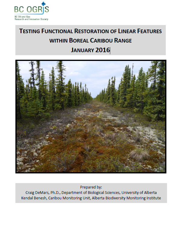
Authors
Craig DeMars
Kendal Benesh
The boreal ecotype of woodland caribou ( Rangifer tarandus caribou) is provincially Red-listed in British Columbia and federally listed as Threatened. Population declines of boreal caribou have been...