Wetlands Knowledge Search Results
Resource
Authors
Alberta Biodiversity Monitoring Institute
As of 2015, 29.2% of Alberta is under human footprint, up from 25.7% in 1999—that’s an average increase of about 0.22%, or around 1450 km2 (560 sections) per year.
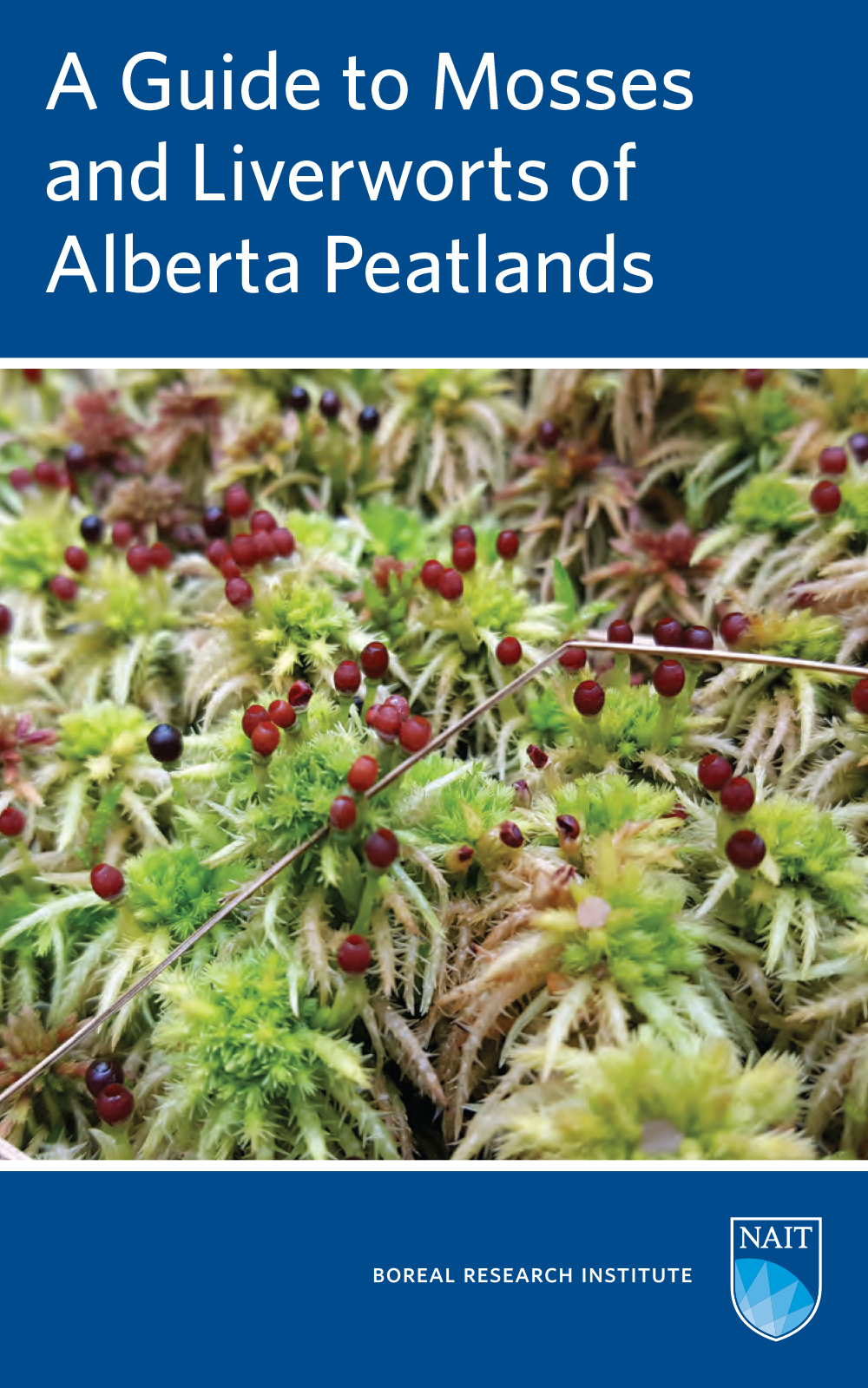
Resource
The guide identifies 60 species of mosses and liverworts that comprise the flora of fens and bogs in Alberta and western boreal Canada, designed for use in the field and laboratory.
Resource
Vegetation workshop was held November 1979 to evaluate user needs for more detailed vegetation descriptions and maps and to review the results of the vegetation survey as a step towards meeting needs
Resource
Authors
Robin Marles
Christina Clavelle
Leslie Monteleone
Natalie Tays
Donna Burns
This book describes the traditional Native American uses of more than 200 plants from Northern forests. Over 100 elders contributed information that they felt should be shared with other communities...
Resource
Resource Date:
December
2019
Aboveground plants provide resources to the belowground microbial community via plant litter and, in turn, the belowground microbial community provides nutrients for plant uptake, linking the two...
Resource
Authors
Barbara Darroch
Surya Acharya
AEC Blueridge alpine bluegrass (Poa alpina L.) is a reclamation variety developed for use in reclaiming and revegetating disturbed sites at high elevations. It is the first variety of alpine bluegrass...
Resource
Authors
M.S. Thompson
J. Crosby-Diewold
Relationship between aquatic macrophyte growth and habitat factors found in the AOSERP study area is outlined, as are some implications of aquatic macrophyte inventory for management and revegetation
Resource
Authors
Alberta Biodiversity Monitoring Institute
We’re pleased to announce the release of the ABMI Alberta-wide Wetland Inventory—our most up-to-date and high-resolution wetland data yet.
Resource
Resource Date:
August
2021
With the support of Alberta Environment and Parks, the Alberta Biodiversity Monitoring Institute has become the trusted source for data about habitat, species, and the human footprint.
Resource
As caribou habitat restoration initiatives have become more widespread across Alberta in the last decade, key uncertainties have been recognized regarding what treatment types are appropriate for...
Resource
Authors
Ronnie Drever
Maria Strack
Kristy Burke
Learn more about the recent work of two renowned Canadian researchers and how their work has benefited from various collaborations and communication across diverse stakeholder groups
Resource
Authors
Evan DeLancey
John Simms
Masoud Mahdianpari
Brian Brisco
Craig Mahoney
Jahan Kariyeva
Developed two wetland inventory style products for a large (397,958 km2) area in the Boreal Forest region of Alberta, Canada, using Sentinel-1, Sentinel-2, and ALOS DEM data
Resource
Authors
Lauren Thompson
McKenzie Kuhn
Johanna Winder
Lucas Braga
Ryan Hutchins
Andrew Tanentzap
Vincent St. Louis
David Olefeldt
Resource Date:
January
2023
Permafrost thaw may increase the production of neurotoxic methylmercury (MeHg) in northern peatlands, but the downstream delivery of MeHg is uncertain. We quantified total mercury (THg) and MeHg...
Resource
Authors
Evan DeLancey
Agatha Czekajlo
Lyle Boychuk
Fiona Gregory
Meisam Amani
Brian Brisco
Jahan Kariyeva
Jennifer Hird
Wetlands in the Prairie Pothole Region (PPR) of Canada and the United States represent a unique mapping challenge. They are dynamic both seasonally and year-to-year, are very small, and frequently...
Resource
Authors
Steven Franklin
Oumer Ahmed
Resource Date:
August
2017
This resource is available on an external database and may require a paid subscription to access it. It is included on the CCLM to support our goal of capturing and sharing the breadth of all...
Resource
Authors
Corey Feduck
Gregory McDermid
Guillermo Castilla
Rapid assessment of forest regeneration using unmanned aerial vehicles (UAVs) is likely to decrease the cost of establishment surveys in a variety of resource industries. This research tests the...
Resource
Authors
Jason Clark
Ken Tape
Latha Baskaran
Clayton Elder
Charles Miller
Kimberley Miner
Jonathan O'Donnell
Benjamin Jones
Beaver engineering in the Arctic tundra induces hydrologic and geomorphic changes that are favorable to methane (CH 4) production. Beaver-mediated methane emissions are driven by inundation of...
Resource
Resource Date:
January
2016
This presentation provides an overview of the Ducks Unlimited Canada Enhanced Wetland Classification System, including current and potential uses for wetland conservation and management.
Resource
Authors
Roger DeAbreu
Shane Patterson
Todd Shipman
Chris Powter
NRCan pilot science projects have proven that Earth Observation can provide relevant and valuable information to inform and enhance monitoring and support regulatory frameworks
Resource
Authors
M.D. Thompson
M.C. Wride
M.E. Kirby
Classification system devised for mapping vegetation and surficial geology from 1:60,000 scale false colour infrared photographs; 1:50 000 base maps plus a vegetation and a surficial geology overlay