Search Results
Displaying:
161 - 180 of 267
Routes to Response: A Conceptual Framework to Detect the Effect of Oil Sands Industrial Activity on the Land
Resource
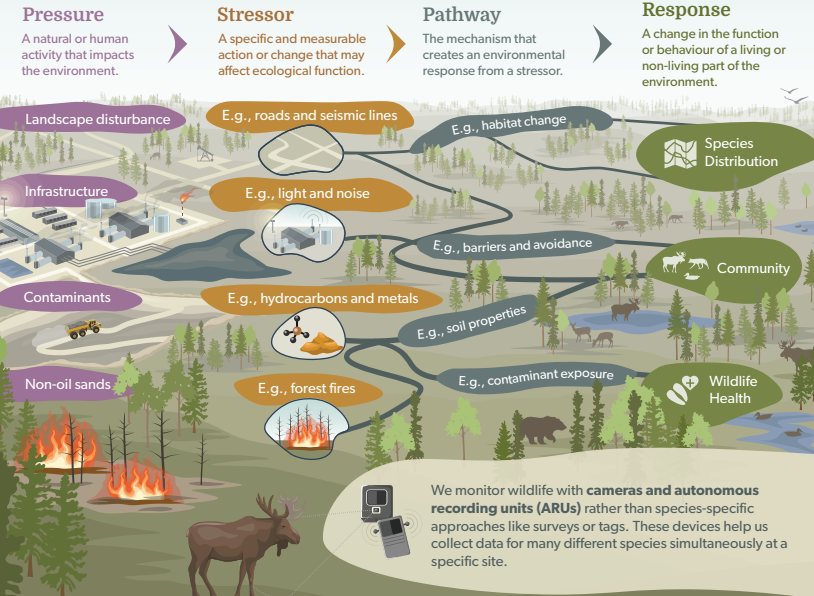
The Oil Sands Monitoring Program is assessing the environmental impacts of oil sands development at different spatial scales. Monitoring in the Oil Sands Region operates under a consistent framework...
Rusty Blackbird (Euphagus carolinus ) Population and Distribution Data in the Athabasca and Cold Lake Oil Sands Regions of Alberta using Automated Recording Units (ARUs)
Resource
The Rusty Blackbird ( Euphagus carolinus ) was listed as Special Concern on Schedule 1 of the federal Species at Risk Act in March 2009 because of large and longterm declines in population size. The...

Saving Endangered Species Using Adaptive Management
Resource
Adaptive management is a powerful means of learning about complex ecosystems, but is rarely used for recovering endangered species. Here, we demonstrate how it can benefit woodland caribou, which...

SENSR (Services for Environmental Sensor Research)
News
Organization
SENSR (Services for Environmental Sensor Research) is the latest ABMI addition to our national affiliate, the non-profit Biodiversity Pathways. SENSR is dedicated to helping you get the most out of...
Slowing Down Wolves to Protect Boreal Caribou Populations: A Spatial Simulation Model of Linear Feature Restoration
Resource
In Canada, boreal caribou ( Rangifer tarandus caribou) are declining in numbers, in part due to increased predation by wolves ( Canis lupus). One management option to reduce wolf–caribou interactions...
Socio-economic Impact Assessment: A Strategy for Planning
Resource
Five alternative socio-economic impact assessment programs were evaluated from the viewpoint of their value for planning.

Soil Resources of Syncrude Lease 22
Resource
Soil patterns in the area are generally quite simple, with large homogeneous soil units. The major criteria for differentiating soils are parent material and drainage conditions.

Soil Survey of a Portion of the Syncrude Lease 17 Area, Alberta
Resource
Soils were inspected and described at 413 sites. Soils of the Luvisolic, Brunisolic, Gleysolic, Cryosolic and Organic Orders were recognized and characterized. depth of peat is

South Bison Hill Soil Capping Research Synthesis
Resource
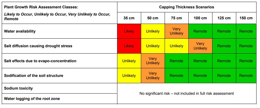
A thickness of 75 cm will provide adequate water supply to vegetation during droughts while also allowing for the release of water to the downstream reclaimed landscape.
Status of Human Footprint in Alberta
Project
Organization:
The ABMI defines human footprint as the visible alteration or conversion of native ecosystems to temporary or permanent residential, recreational, agricultural, or industrial landscapes. The...

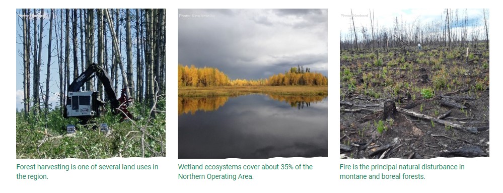
Status of Land Cover and Biodiversity in Norbord Inc.'s Operating Areas
Resource
This online report describes the status of human footprint, species, and habitat in Norbord Inc.'s two main operating areas located in northwestern Alberta. This information establishes baseline...
Syncrude Lease No. 17: An Archaeological Survey
Resource
All reported archaeological finds in the Boreal Mixedwood Ecosystem of Alberta and pertinent ethnohistorical and ethnographic literature concerning Native Groups of the general region are reviewed

Test of a Bird Deterrent Device at a Tailings Pond, Athabasca Oil Sands, 1974
Resource
Shorebirds readily landed on the shore of this pond and were observed to pick up bitumen on their feet and legs. Hazard considered small although some shorebirds are known to have died at this pond

Testing UAV-based Remote Sensing for Monitoring Well Pad Recovery
Resource
UAV-based remote sensing as a method for monitoring well pad recovery is determined to be feasible from a technical and field perspective.

The Alberta Biodiversity Monitoring Program: Monitoring Aquatic Systems
Resource
Protocols for sampling biotic and abiotic parameters in large lakes, large rivers, wetlands, and streams in Alberta is provided. Estimates of time costs are given.
The Beaver Creek site: A Prehistoric Stone Quarry on Syncrude Lease #22
Resource
Archaeological reconnaissance on Syncrude Lease #17 noted that over 67% of the total stone assemblage recovered from 28 localities consists of quartzite derived from the Beaver Creek Quarry
The Habitat of Syncrude Tar Sands Lease #17: An Initial Evaluation
Resource
Syncrude Canada Ltd. Lease 17 is located in the boreal mixedwood forest ecosystem. Twelve terrestrial and aquatic habitat types exist

The Hydrology of Lease 17: A Report of Studies Completed in the Year 1973
Resource
Flood frequency prediction for Syncrude Lease 17 is necessary for both mining activities and environmental protection. Flood frequency curves can be derived from one year’s local data

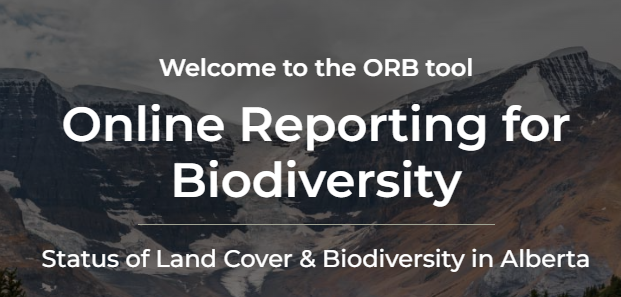
The ORB Tool has Launched!
News
Organization
The Online Reporting for Biodiversity (ORB) tool is a user-friendly platform for generating biodiversity and land cover reports for different areas in Alberta, including natural regions, watersheds...