
Search Results
Displaying:
81 - 100 of 260
Environmenta1 Planning for Rights-of-way
Resource
A recent study (using a 10% stratified random sample) estimated the amount of area physically disturbed by energy related activity, to be 66,576 acres (26,963 ha) for a selective study area...
Environmental and Management Drivers of Carbon Dioxide and Methane Emissions From Actively-Extracted Peatlands in Alberta, Canada
Resource
The installation of drainage ditches and removal of vegetation in preparation for vacuum harvesting alters the carbon dynamics of peatlands. However, we lack the measurements to understand the spatial...

Environmental Controls on Carbon Sequestration in a Saline, Boreal, Peat-Forming Wetland in the Athabasca Oil Sands Region
Resource
Saline boreal fens represent potential models for post-mining landscape reclamation in the Athabasca Oil Sands Region (AOSR) (Canada) where wetland construction is challenged by salinization. One of...

Environmental Controls on CO2 Exchange Along a Salinity Gradient in a Saline Boreal Fen in the Athabasca Oil Sands Region
Resource
This resource is available on an external database and may require a paid subscription to access it. It is included on the CCLM to support our goal of capturing and sharing the breadth of all...

Environmental Fate and Transport of Organic Contaminants in Soils at Waste Disposal Sites
Resource
Current approaches for describing the environmental dynamics of organic constituents in complex waste mixtures are reviewed. Factors controlling equilibrium and nonequilibrium sorption of organic...

Erosion Monitoring on Mountain Foothills Waste Dumps
Resource
The erosion study was designed to examine the effects of the regraded configuration (i.e. slope angle, slope length), waste material characteristics, age since reclamation, amount of precipitation...

Establishment of Native Boreal Plant Species on Reclaimed Oil Sands Mining Disturbances
Resource
Current revegetation strategies for disturbed oil sands sites include values such as biodiversity and sustainability. As a result, a wide range of species are sought for inclusion in revegetation...
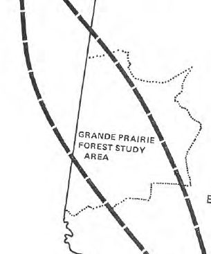
Establishment of Trees and Shrubs on Mined Land in the Grande Cache Area
Resource
The Terrain Sciences Department of the Alberta Research Council has been conducting a reclamation research program at the operations of Smoky River Coal Limited in the Grande Cache area since 1972...

Evaluating the Hydrological Response of a Boreal Fen Following the Removal of a Temporary Access Road
Resource
Removal and reclamation should be considered as a worthwhile venture for roads that extend through fens and are no longer in use.
Evaluation of Alternative Procedures and Equipment for Conserving Topsoil During Pipeline Construction in Western Canada
Resource
Topsoil conservation has become standard practice on pipeline construction in western Canada over the last 30 years. Pipeline contractors have used a variety of procedures and equipment with different...
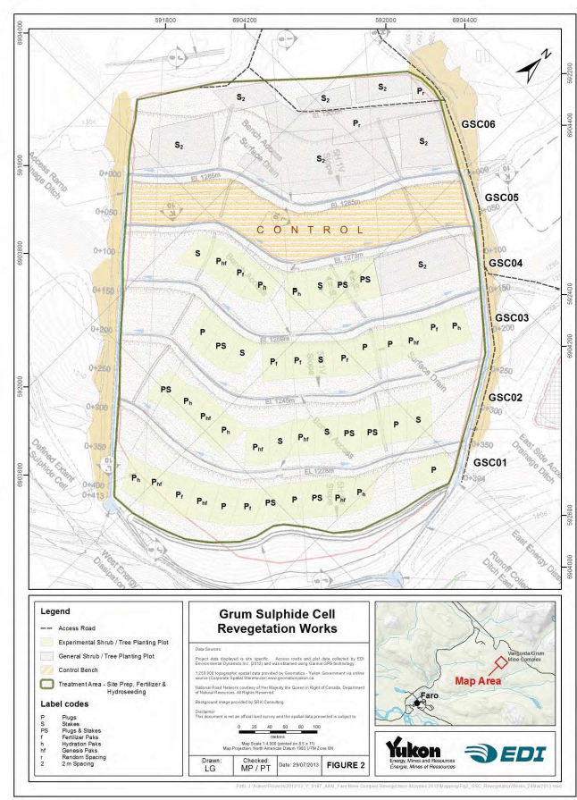
Faro Mine Complex Revegetation Activities
Resource
In preparation for remediation and closure of the Faro Mine Complex (FMC), significant work has been completed to develop and test revegetation methods at the mine site. Development and implementation...
Field Assessment of Sulphide Oxidation Rates in Cold Environment: Case Study of Raglan Mine
Resource
In this field study conducted on Raglan Mine's tailings storage facility (TSF), tailings oxidation rates were characterized with the oxygen consumption (OC) method. Surface tailings unfrozen...

Fisheries Habitat Mitigation for the Oldman River Dam Project
Resource
The government of Alberta has set an objective of "no net loss of recreational fishing opportunities as a result of the Oldman River Dam project". In May of 1988, a further commitment was made by the...
Footprints: The Evolution of Land Conservation and Reclamation in Alberta
Resource
This book is written to help assess how effectively we have, or are, conserving our land base and providing the stewardship required to pass our legacy on to our progeny.

Galena Hill, Yukon, Ecosystem Mapping Project
Resource
The Galena Hill Ecosystem Map (GHEM) was initially developed to provide information about existing plant communities and their growth conditions to guide upcoming reclamation efforts at the historical...

Geomechanical Investigation of Post Reclamation Subsidence of Prairie Strip Mine Spoil
Resource
The post-reclamation subsidence of cast-back overburden is of interest to mining companies and regulatory agencies. Although subsidence may be of lesser concern than the prevention of soil degradation...

Graminoids Vary in Functional Traits, Carbon Dioxide and Methane Fluxes in a Restored Peatland: Implications for Modeling Carbon Storage
Resource
One metric of peatland restoration success is the re-establishment of a carbon sink, yet considerable uncertainty remains around the timescale of carbon sink trajectories. Conditions post-restoration...