
Search Results
Displaying:
1 - 20 of 22
A Review and Assessment of the Baseline Data Relevant to the Impacts of Oil Sands Developments on Large Mammals in the AOSERP Study Area
Resource
Major gaps in the baseline knowledge of woodland caribou were: distribution , seasonal habitat use, the effects of sensory disturbance, and population density; minor gap re: direct mortality

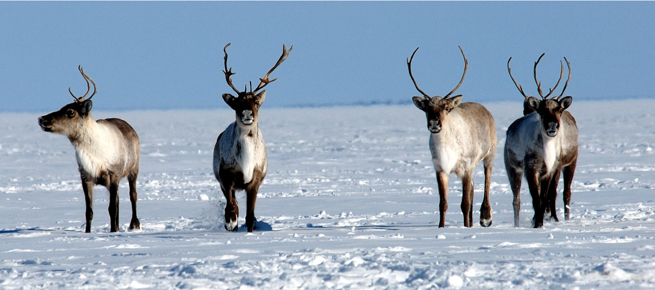
Action Plan for the Bluenose-East Caribou Herd
Resource
A 56-page action plan for the Bluenose-east herd prepared by the wildlife management boards with stewardship responsibilities for barren-ground caribou and their habitat in the Northwest Territories...

Amphibians and Reptiles in the AOSERP Study Area
Resource
Wood frog (Rana sylvatica) was the most abundant and widespread species in 20 sites examined. Boreal chorus frogs (Pseudacris triseriata maculata) and Canadian toads (Bufohemiophrys) found at

An Assessment of the Adequacy of Baseline Data Relevant to the Documentation and Evaluation of the Impacts of Oil Sands Developments on Large Mammals in the AOSERP Study Area.
Resource
An analysis of the applied research necessary to allow evaluation of the effects of oil sands development on large mammals by a review and evaluation of the available baseline data

Biogeochemical Response to Vegetation and Hydrologic Change in an Alaskan Boreal Fen Ecosystem
Resource
Boreal peatlands store approximately one third of the earth’s terrestrial carbon, locked away in currently waterlogged and frozen conditions. Peatlands of boreal and arctic ecosystems are affected...

Decision-support Tools to Assess Cumulative Effects on the Cape Bathurst, Tuktoyaktuk Peninsula, Bluenose-West, and Bluenose-East Herds of Barren-ground Caribou – Project Summary Report
Resource
This report summarizes a project whose purpose was to collaboratively develop decision-support tools that will help northern decision-makers review, explore, and learn about the cumulative effects of...

Does Dust from Arctic Mines Affect Caribou Forage?
Resource
A 2017 paper assessing the impacts of dust from a mining haul road in the NWT on vegetation used by caribou. The paper concluded that dust from the road negatively affected the vegetation within a...

Interim Report on a Soils Inventory in the Athabasca Oil Sands Area 1978
Resource
The emphasis in this inventory is on soils and the landforms on which they occur; both are indicated on maps. Air photo interpretation and field checking have been completed

Joint Management Proposals for: Sahtì (Bluenose-East) Ekwǫ̀ Herd, and Kǫk’èetı (Bathurst) Ekwǫ̀ Herd
News
Following a calving ground survey last June and a composition survey last October, the population for Sahtì Ekwǫ̀ is estimated to be 23,200 animals – about 4,000 more than in 2018. However, this total...
Northern Caribou Canada
Project
Contact
Organization:
About the Northern Caribou Canada: Who This is a project of the Wekʼèezhìi Renewable Resources Board in collaboration with the organizations, governments, and agencies listed on the bottom of the page...

Peat Loss Collocates with a Threshold in Plant–Mycorrhizal Associations in Drained Peatlands Encroached by Trees
Resource
Drainage-induced encroachment by trees may have major effects on the carbon balance of northern peatlands, and responses of microbial communities are likely to play a central mechanistic role. We...

Reasons for Decision Final Report, Part B - Bluenose-East Caribou Herd
Resource
Serious conservation concern exists for the Bluenose-East caribou herd and additional management actions are vital for herd recovery. The first report, Part A, dealt with the proposed harvest...
Reasons for Decisions Related to a Joint Proposal for Dìga (Wolf) Management in Wek’èezhìı
Resource
A 109-page document on the reasons for decision of the Wek’èezhìı Renewable Resources Board regarding wolf management in the region.
Soils Inventory of the Alberta Oil Sands Environmental Research Program Study Area
Resource
Recurring patterns of soils, landforms, and vegetation were delineated. The information was transferred first to 1:50,000 preliminary maps and then to eight 1:126,720 maps which accompany this report

The Third Generation of Pan-Canadian Wetland Map at 10 m Resolution Using Multisource Earth Observation Data on Cloud Computing Platform
Resource
Development of the Canadian Wetland Inventory Map (CWIM) has thus far proceeded over two generations, reporting the extent and location of bog, fen, swamp, marsh, and water wetlands across the country...
Tǫdzı (Boreal Caribou) and the State of Their Habitat
Project
Organization:
Project Description: This report considers Tłı̨chǫ knowledge of the relationships that tǫdzı (boreal caribou) have with their habitat, including human and other-than human beings. The current...
")
Tǫdzı (Boreal Caribou) and the State of Their Habitat
Resource
This report considers Tłı̨chǫ knowledge of the relationships that tǫdzı (boreal caribou) have with their habitat, including human and other-than human beings.
")