
Search Results
Displaying:
1 - 20 of 20
Comparison of Soil Quality and Productivity of Reclaimed and Native Oil Sands Soils
Resource
The primary target of land reclamation in the Athabasca Oil Sands (AOS) region of Canada is to re-create ecosystems which are similar to the pre-disturbance ecosystems. The main objective of this...

Extending the National Burned Area Composite Time Series of Wildfires in Canada
Resource
This study created a 35-year time series of wildfire burned areas in Canada from 1986 to 2020, using data from satellite imagery and aerial surveys. Wildfires are a major natural disturbance in Canada...

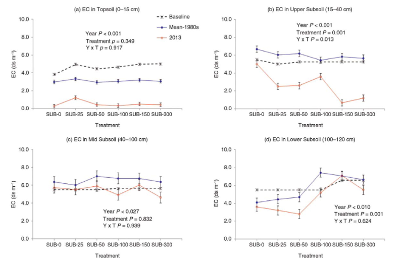
Long-term Changes in Soil Salinity as Influenced by Subsoil Thickness in a Reclaimed Coal Mine in East-central Alberta
Resource
Elevated salinity and sodicity are major challenges to reclamation of surface-mined coal sites in the Alberta Plains region. Research plots were established in 1981 at the Battle River Coal Mine near...
Network of Wildlife Cameras and Audio Recorders Expanded to Better Monitor Biodiversity
News
Organization
Biodiversity monitoring partners across the NWT are getting a closer look at wildlife as the Government of the Northwest Territories’ Biodiversity Monitoring Program expands. Remote cameras and audio...
Online Course: SOIL 210 Soil Science for Archaeology
Event
Event Date and Time
March 22nd, 2002 at 9:00am MST to April 21st, 2022 at 12:00pm MST
Organization
25-hour introductory soil science course led by Dr. Konstantin Dlusskiy includes elements of surficial geology relevant to archaeological investigations

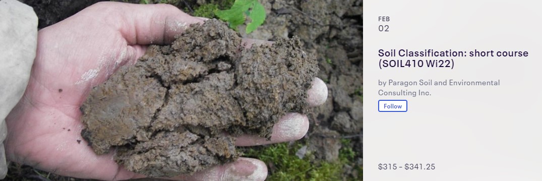
Online Course: Soil Classification: Short Course (SOIL410 Wi22)
Event
Event Date and Time
February 2nd, 2022 at 8:00am MST to February 3rd, 2022 at 5:00pm MST
Organization
Advanced short course on soil classification
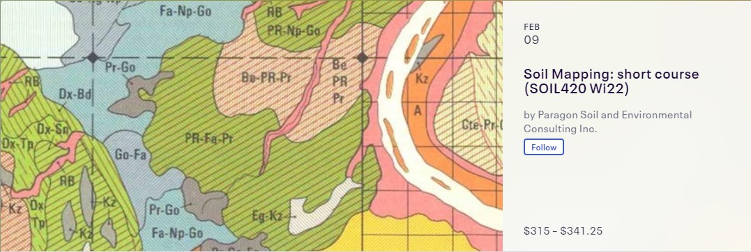
Online Course: Soil Mapping: Short Course (SOIL420 Wi22)
Event
Event Date and Time
February 9th, 2022 at 8:00am MST to February 10th, 2022 at 5:00pm MST
Organization
Advanced online course on soil survey and mapping
Registration Open for Soil Classification: Short Course (SOIL410 Wi22)
News
Organization
This advanced soil science course led by Dr. Konstantin Dlusskiy focuses on: Common landforms and parent materials associated with soils in Prairies, Soil drainage classes and soil moisture regimes...
Registration Open for Soil Mapping: Short Course (SOIL420 Wi22)
News
Organization
Advanced online course on soil survey and mapping
SOIL 230: Pedology Field School
Event
Event Date and Time
May 21st, 2024 at 8:00am MST to May 23rd, 2024 at 5:00pm MST
, AB
Organization
This 24-h introductory soil science course is fully field-based. The 3-day field school led by Dr. Konstantin Dlusskiy focuses on hands-on experience with application to industry standards. •...

SOIL 410: Soil Classification Course
Event
Event Date and Time
March 27th, 2024 at 8:00am MST to March 28th, 2024 at 5:00pm MST
Organization
This advanced soil science course led by Dr. Konstantin Dlusskiy focuses on: • Common landforms and parent materials associated with soils in Prairies • Soil drainage classes and soil moisture regimes...

SOIL 420: Soil Mapping Course
Event
Event Date and Time
April 3rd, 2024 at 8:00am MST to April 4th, 2024 at 5:00pm MST
Organization
This advanced soil science course led by Dr. Konstantin Dlusskiy focuses on: • The process of soil survey Prediction of soil types based on imagery interpretation Design of soil map legends...

The Multisource Vegetation Inventory (MVI): A Satellite-Based Forest Inventory for the Northwest Territories Taiga Plains
Resource
Wall-to-wall 30 m raster maps of broad forest type, stand height, crown closure, stand volume, total volume, aboveground biomass, and stand age were created for a ~400,000 km2 area, validated with independent data, and generalized into a polygon GIS layer resembling a traditional FI map. The MVI project showed that a reasonably accurate FI map for large, remote, predominantly non-inventoried boreal regions can be obtained at a low cost by combining limited field data with remote sensing data from multiple sources.