Wetlands Knowledge Search Results
Resource
Authors
George LaRoi
Mike Ostafichuk
16 undisturbed, 5-ha, permanent plots dominated by Pinus banksiana (jack pine) were established along an impingement gradient of atmospheric emissions from oil sands processing plants
Resource
Authors
C.S. Davis
P. Fellin
D. Stevens
S. Todd
K. Heidorn
Since the determination of the environmental impact of two major pollution sources on precipitation quality was a primary project objective, poor collection efficiencies did not satisfy the objective
Resource
Objective to evaluate the streamflow, suspended sediment, lake level, and water quality networks in the AOSERP study area so as to provide the basis for continuation and/or redirection.
Resource
In this year we analyzed the study landscape using GIS, reclassified AVI data into deer habitat categories, and created the experimental design for sampling deer occupancy using remote cameras. We...
Resource
Plots were established to monitor the survival of immature lodgepole pine ( Pinus contorta var. latifolia Engelm.) in over 70 cutover areas in the subalpine and boreal forest regions of west-central...
Resource
Authors
Christopher Shank
Erin Bayne
The Alberta Ferruginous Hawk Recovery Plan 2009 – 2014 identifies climate change as a factor potentially threatening the recovery of the species in Alberta.
Resource
Authors
S. Couturier
Aaron Dale
Jennifer Mitchell Foley
J. Snook
B. Wood
Formal report of the results of the 2014 aerial survey of the Torngat Mountains caribou herd.
Resource
Authors
Garry Scrimgeour
Sharon Kendall
This chapter describes aquatic elements and sampling protocols that could be used to monitor forested stream ecosystems in Alberta and Saskatchewan
Resource
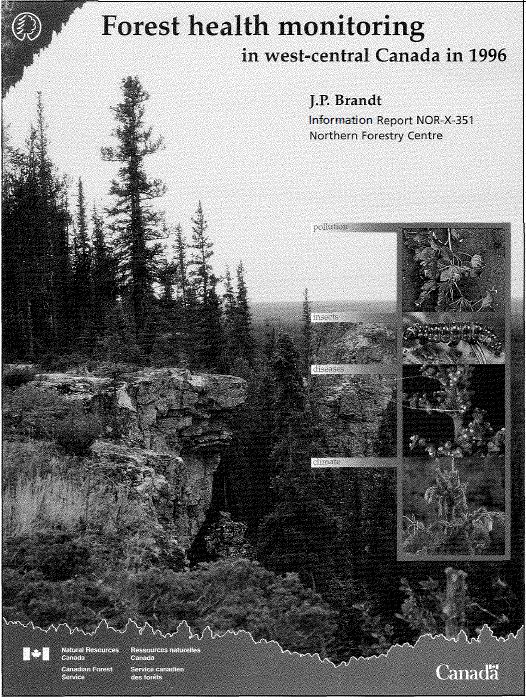
Results of forest health monitoring activities in Alberta, Saskatchewan, Manitoba, and the Northwest Territories are summarized for 1996. These results are based on assessments made on 17 permanent...
Resource
Authors
Sylvain Ménard
Marcel Darveau
Louis Imbeau
Forest inventory maps can be used to quantify the area of wetland habitats and to define homogeneous regions in this regard, and therefore provide a functional tool for coarse-scale wetland management
Resource
The Galena Hill Ecosystem Map (GHEM) was initially developed to provide information about existing plant communities and their growth conditions to guide upcoming reclamation efforts at the historical...
Resource
Authors
United Nations Environment Programme
Resource Date:
November
2022
Peatlands are unique and rare ecosystems that, despite only covering around 3-4% of the planet’s land surface, they contain up to one-third of the world’s soil carbon, which is twice the amount of...
Resource
Summary of the meteorological data collected by the meteorological tower network in the Gregoire Lake region of northeast Alberta during the spring and summer of 1979 to monitor impact of Amoco plant
Resource
Breeding bird studies using the mapping method were combined with intensive habitat quantification to determine the relative values to breeding avifauna of 21 habitat types
Resource
A 30-page report from 2012 on the Yukon portion of the herd’s range. It includes discussion of the potential impacts of forest fires. This resource and others can be found on the Northern Caribou...
Resource
Six hundred Douglas-fir (Pseudotsuga menziesii) and 600 lodgepole pine (Pinus contorta var. latifolia) seedlings were planted on seven plots in a cutover north of Golden, British Columbia, to...
Resource
Authors
C. Bulmer
M.G. Schmidt
B. Kishchuk
C. Preston
We investigated soil factors and tree growth on sites that were clearcut during the 1970s and early 1980s and were subsequently site prepared with either blade scarification (blading) or prescribed...
Resource
Soil conditions, growth of 1200 planted seedlings each of lodgepole pine ( Pinus contorta var. latifolia) and Douglas-fir ( Pseudotsuga menziesii), and development of other vegetation were studied to...
Resource
Authors
Corey Scobie
Alan Marsh
Ryan Fisher
Erin Bayne
Troy Wellicome
Petroleum development has occurred at a rapid pace on the grasslands of Alberta and Saskatchewan. To avoid potential impacts of development on burrowing owls, federal and provincial governments...
Resource
Authors
Larry Turchenek
J.D. Lindsay
The emphasis in this inventory is on soils and the landforms on which they occur; both are indicated on maps. Air photo interpretation and field checking have been completed