Wetlands Knowledge Search Results
Resource
Forest fire is the primary natural disturbance process influencing the distribution and abundance of terrestrial lichens across ranges of woodland caribou ( Rangifer tarandus caribou), including the...
Resource
Authors
Curtis Brinker
Marc Symbaluk
J.G. Boorman
Pit reclaimed such that the end pit and inlet/outlet streams would sustain in perpetuity the full range of habitat and watershed features needed to support native Athabasca Rainbow and Bull Trout
Resource
Authors
Committee on the Status of Endangered Wildlife in Canada
The 2016 assessment report on barren-ground caribou prepared by the Committee on the Status of Endangered Species in Canada (COSEWIC). It is a long, thorough and quite technical overview. It resulted...
Resource
Authors
Committee on the Status of Endangered Wildlife in Canada
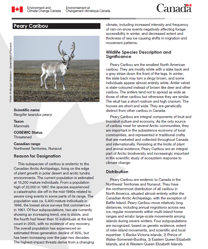
A 2015 assessment and status report on Peary caribou from the Committee on the Status of Endangered Wildlife in Canada (COSEWIC). This resource and others can be found on the Northern Caribou Canada...
Resource
Authors
Trevor Hesselink
Anna Baggio
Resource Date:
December
2013
With this project, we examined alternate proposals for a major new ~300km transmission line in Northwestern Ontario designed to supply additional capacity to Pickle Lake. We provided summary...
Resource
Authors
Terry Larsen
A. Sorensen
C. McClelland
Gordon Stenhouse
To understand how oil and gas activities and access control measures, particularly gates, influences grizzly bears and their habitats in Alberta, we used multiple data sources including spatial layers...
Resource
In this year we analyzed the study landscape using GIS, reclassified AVI data into deer habitat categories, and created the experimental design for sampling deer occupancy using remote cameras. We...
Resource
A 2015 three-page fact sheet on Peary caribou produced by the Canadian government. This resource and others can be found on the Northern Caribou Canada website. To find more related resources click...
Resource
Authors
S. Konkolics
Melanie Dickie
Robert Serrouya
Stan Boutin
To examine the effects of forest fires on woodland caribou, we collected GPS location data on five caribou ranges in northeastern Alberta.
Resource
Authors
Canadian Conservation and Land Management Knowledge Network
View this infographic to learn more about how an open source model using artificial intelligence is contributing to significant time and cost savings in identifying and classifying camera trap data.
Resource
Resource Date:
March
2016
To meet federal Recovery Strategy objectives, the Government of the Northwest Territories, Environment and Natural Resources Department (GNWT-ENR) is developing a set of regional plans to demonstrate...
Resource
Authors
B. Critescu
Gordon Stenhouse
Marc Symbaluk
M.S. Boyce
Following closure, access management on designated trails will reduce risk of conflicts. Imposing access restrictions, preserving undisturbed habitat patches and restoring original vegetation
Resource
Authors
Laura Finnegan
Suzanne Stevenson
Chris Johnson
Tracy McKay
Resource Date:
February
2021
With of goal of understanding how silviculture and harvesting practices might mirror those of natural disturbances, here we summarize research describing differences in responses of caribou and...
Resource
Beavers, Canada's national animal, provide many valuable ecosystem services including storage of water during droughts and flooding, creation of habitat for a variety of species, and improvement of...
Resource
Authors
Doug MacNearney
Karine Pigeon
Laura Finnegan
Resource Date:
October
2016
We used GPS telemetry location data from 63 adult caribou and 6 adult wolves to build spatially explicit resource selection function (RSF) rasters. These RSF rasters describe the within-home-range...
Resource
Resource Date:
September
2017
We, Fort Nelson First nation (FNFN), are People of the land and the rivers and have lived in our territory in northeastern British Columbia since time immemorial. We are also Treaty people. Treaty No...
Resource
Objectives of the waterfowl surveys are: 1) To monitor waterfowl migrations through the Syncrude Lease 17 and general area during all seasons of use. 2) To establish the locations and intensity of use
Resource
Authors
Ken Foster
Christine Godwin
Peter Pyle
The MAPS protocol (Monitoring Avian Productivity and Survivorship) was applied in a 2011 pilot program in the boreal forest in the oil sands region
Resource
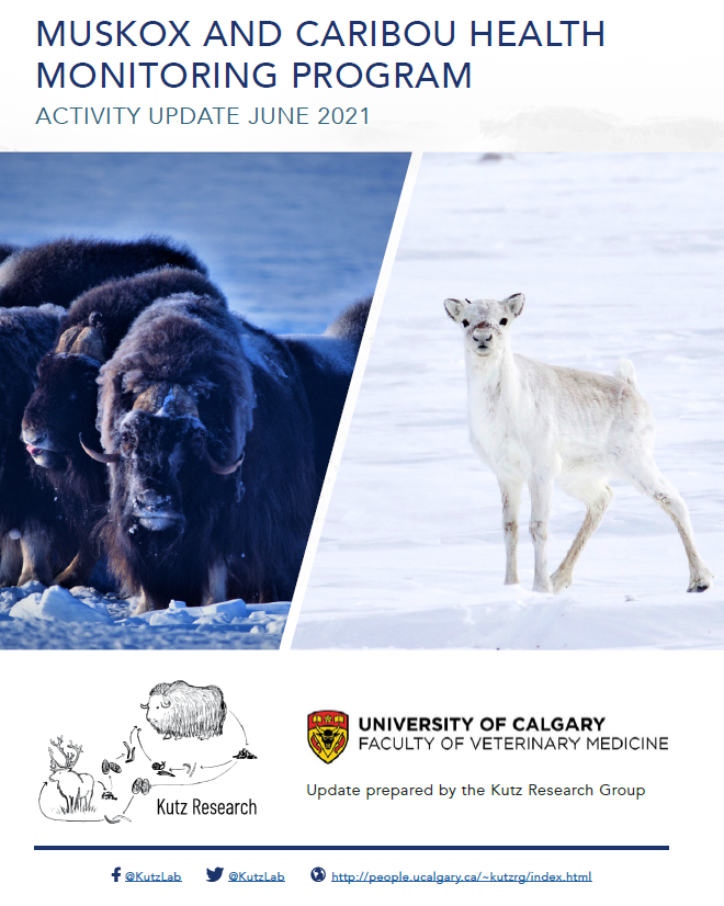
This 12-page document gives brief summaries about work on muskox and caribou in the central Arctic region of Canada (communities of Ulukhaktok, Kugluktuk and Cambridge Bay).
Resource
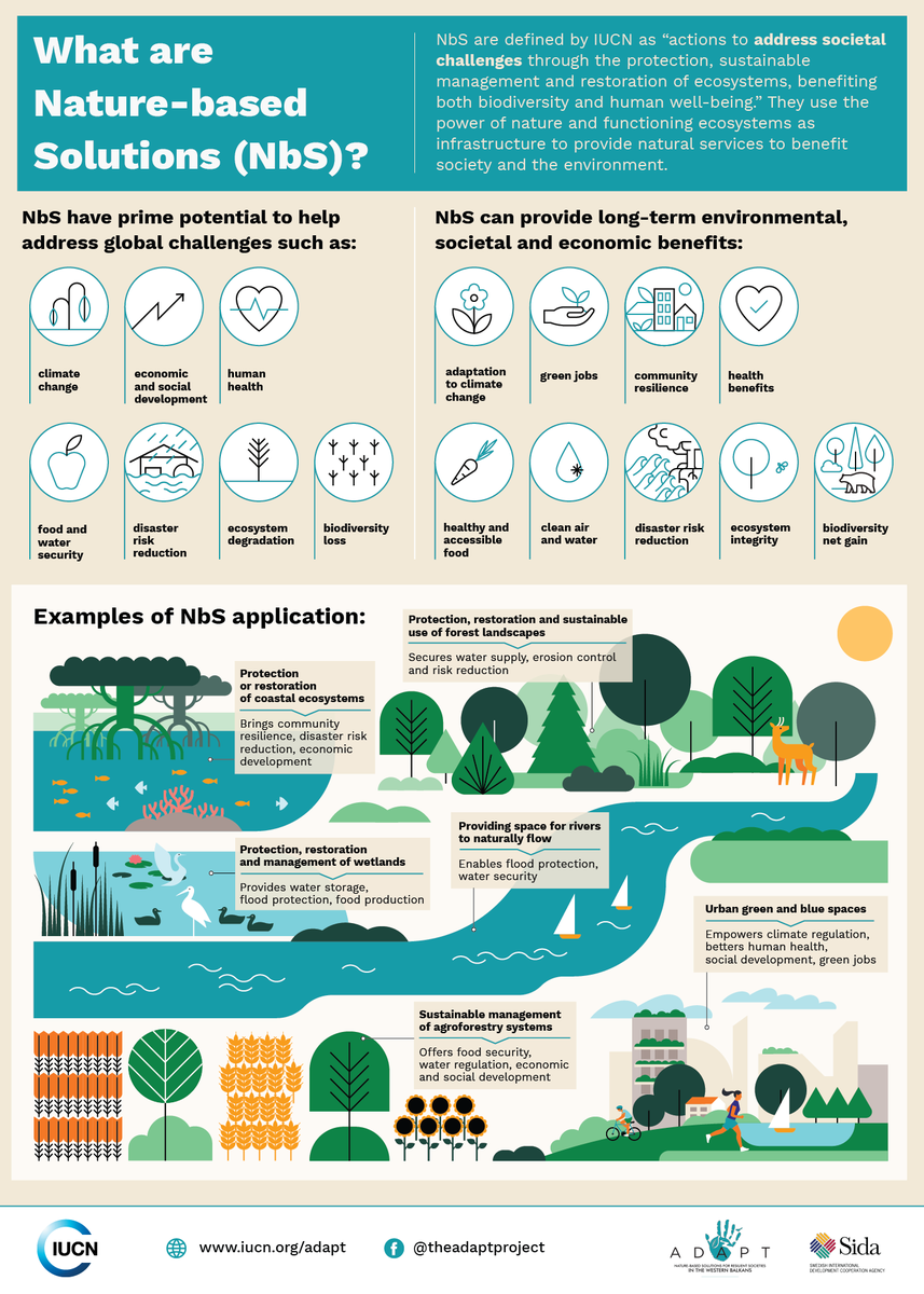
Nature-based Solutions leverage nature and the power of healthy ecosystems to protect people, optimise infrastructure and safeguard a stable and biodiverse future. Explore topics related to Nature...