Wetlands Knowledge Search Results
Resource
Authors
Alberta Biodiversity Monitoring Institute
As of 2015, 29.2% of Alberta is under human footprint, up from 25.7% in 1999—that’s an average increase of about 0.22%, or around 1450 km2 (560 sections) per year.
Resource
Authors
Dennis Cook
Jerald Jacobson
Study designed to develop an analysis model which would produce statistically reliable estimates of visibility bias and total population
Resource
Authors
Marcus Becker
Dave Huggard
Melanie Dickie
Camille Warbington
Jim Schieck
Emily Herdman
Robert Serrouya
Stan Boutin
Estimating animal abundance and density are fundamental goals of many wildlife monitoring programs. Camera trapping has become an increasingly popular tool to achieve these monitoring goals due to...
Resource
Authors
Aaron Sekerak
Gordon Walder
Maps showing fish collection locations, photos and details of the physical characteristics of nine streams within five watersheds (Firebag, Muskeg, Steepbank, MacKay, and Ells) in AOSERP study area
Resource
Authors
Alberta Biodiversity Monitoring Institute
Alberta Innovates - Technology Futures
With few exceptions, permeability across in situ developments was the main factor affecting caribou movement. Relationship was non-linear, suggesting a minimum threshold of permeability is needed
Resource
Resource Date:
August
2021
With the support of Alberta Environment and Parks, the Alberta Biodiversity Monitoring Institute has become the trusted source for data about habitat, species, and the human footprint.
Resource
Authors
Christopher Shank
Amy Nixon
This report provides a broad overview of how Alberta species are likely to be affected by climate change by the 2050s. Amphibians were consistently found to be the most vulnerable to climate change
Resource
Authors
Diana Stralberg
Erin Bayne
Steven Cumming
Péter Sólymos
Samantha Song
Fiona Schmiegelow
For some boreal songbirds, limits to forest growth and succession may result in dramatic reductions in suitable habitat over the next century.
Resource
Authors
Lauren Thompson
McKenzie Kuhn
Johanna Winder
Lucas Braga
Ryan Hutchins
Andrew Tanentzap
Vincent St. Louis
David Olefeldt
Resource Date:
January
2023
Permafrost thaw may increase the production of neurotoxic methylmercury (MeHg) in northern peatlands, but the downstream delivery of MeHg is uncertain. We quantified total mercury (THg) and MeHg...
Resource
Authors
James Saracco
Peter Pyle
Danielle Kaschube
Monica Kohler
Christine Godwin
Kenneth Foster
Habitat loss and disturbance from industrial resource development may be contributing to declines in boreal bird populations. We applied hierarchical multi-species models to data from 31 bird species...
Resource
Authors
Qihua Huang
Hao Wang
Mark Lewis
Previous work has considered the effect of a toxin on the population dynamics of a single trophic level, such as fish, we focus on the impacts of toxins on the population dynamics of aquatic food webs
Resource
Authors
Amy Darling
Carol Stefan
Corey De La Mare
Canada’s boreal forest is important habitat for many North American birds, which play a vital role in the health of forests, and provide ecosystem services. Expanding human development in northern...
Resource
Authors
Erin Bayne
Hedwig Lankau
Jesse Tigner
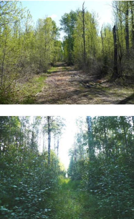
We conducted a series of surveys to evaluate wildlife responses to different types of seismic lines in bogs, conifer‐dominated, mixedwood and deciduous forests in the western boreal forest. Research...
Resource
Authors
Cole Burton
Christopher Beirne
Catherine Sun
Erin Tattersall
Joanna Burgar
Jason Fisher
This project has clearly demonstrated the utility of camera trap surveys for monitoring restoration effectiveness in boreal environments. The cameras facilitated the collection of longitudinal data on...
Resource
The Emend for Schools: 360° Video EMEND Tour Teachers Resource is a full lesson plan and 360 immersive and interactive video teaching tool, including a teacher lesson plan and student workbook aligned...
Resource
Authors
Chris Stockdale
Quinn Barber
Amit Saxena
Marc-Andre Parisien
Resource Date:
March
2019
We undertook a wildfire risk assessment across the Cold Lake caribou range where we used the Burn-P3 model to determine: a) burn probability; b) wildfire risk to restored seismic line areas; and c) the effectiveness of mitigation measures. The burn probability of the landscape was highly heterogeneous, and recent large burns and some waterbodies provided “shields” that reduced burn probability on their leeward sides.
Resource
Authors
Mathilde Lapointe St-Pierre
Julie Labbé
Marcel Darveau
Louis Imbeau
Marc Mazerolle
This resource is available on an external database and may require a paid subscription to access it. It is included on the CCLM to support our goal of capturing and sharing the breadth of all...
Resource
Authors
Tyler Flockhart
Greg Mitchell
Richard Krikun
Erin Bayne
Successful conservation of migratory birds demands we understand how habitat factors on the breeding grounds influences breeding success. Multiple factors are known to directly influence breeding...
Resource
Breeding bird studies using the mapping method were combined with intensive habitat quantification to determine the relative values to breeding avifauna of 21 habitat types
Resource
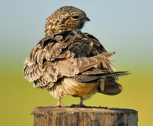
Conservation management is impeded by the lack of baseline data for many non-passerine, cryptic, or nocturnal species that are inadequately sampled by traditional monitoring programs. The recent rise...