
Search Results
Displaying:
1 - 9 of 9
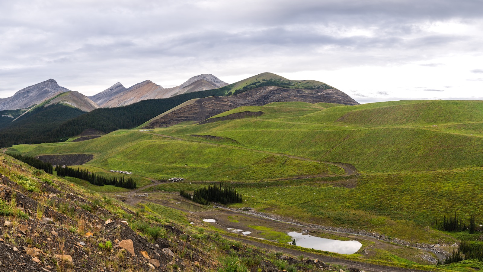
Balancing Focal Species, Recreation and Biodiversity in Mountain Coal Mine Closure Planning – Alberta, Canada
Resource
Goals: Maintain and enhance focal species habitat and populations; preserve pre-disturbance or modified recreational land use opportunities; and approximate pre-disturbance native biological diversity

Caribou Use of Habitat Near Energy Development in Arctic Alaska
Resource
Increasing demands for energy have generated interest in expanding oil and gas production on the North Slope of Alaska, USA, raising questions about the resilience of barren-ground caribou ( Rangifer...

Reclamation Operations at Cardinal River Coals Ltd.
Resource
Cardinal River Coals, Ltd. is a joint coal mining venture owned 50% by Luscar, Ltd. and 50% by Consolidation Coal, Co. of Canada. The minesite is located approximately 40 kilometres south of Hinton...
Species-Specific Responses to Wetland Mitigation among Amphibians in the Greater Yellowstone Ecosystem
Resource
This resource is available on an external database and may require a paid subscription to access it. It is included on the CCLM to support our goal of capturing and sharing the breadth of all...

Survival and Reproduction in Arctic Caribou are Associated with Summer Forage and Insect Harassment
Resource
Investigators have speculated that the climate-driven “greening of the Arctic” may benefit barren-ground caribou populations, but paradoxically many populations have declined in recent years. This...
The Boreal-Arctic Wetland and Lake Dataset
Resource
Here we present the Boreal–Arctic Wetland and Lake Dataset (BAWLD), a land cover dataset based on an expert assessment, extrapolated using random forest modelling from available spatial datasets of...
The Third Generation of Pan-Canadian Wetland Map at 10 m Resolution Using Multisource Earth Observation Data on Cloud Computing Platform
Resource
Development of the Canadian Wetland Inventory Map (CWIM) has thus far proceeded over two generations, reporting the extent and location of bog, fen, swamp, marsh, and water wetlands across the country...