
Search Results
Displaying:
61 - 80 of 91
Satellite Determination of Peatland Water Table Temporal Dynamics by Localizing Representative Pixels of A SWIR-Based Moisture Index
Resource
The OPtical TRApezoid Model (OPTRAM) is a physically-based approach for remote soil moisture estimation. OPTRAM is based on the response of short-wave infrared (SWIR) reflectance to vegetation water...

Socio-economic Impact Assessment: A Strategy for Planning
Resource
Five alternative socio-economic impact assessment programs were evaluated from the viewpoint of their value for planning.

Soil Resources of Syncrude Lease 22
Resource
Soil patterns in the area are generally quite simple, with large homogeneous soil units. The major criteria for differentiating soils are parent material and drainage conditions.

Soil Survey of a Portion of the Syncrude Lease 17 Area, Alberta
Resource
Soils were inspected and described at 413 sites. Soils of the Luvisolic, Brunisolic, Gleysolic, Cryosolic and Organic Orders were recognized and characterized. depth of peat is

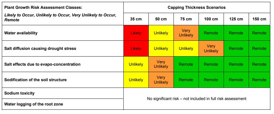
South Bison Hill Soil Capping Research Synthesis
Resource
A thickness of 75 cm will provide adequate water supply to vegetation during droughts while also allowing for the release of water to the downstream reclaimed landscape.
Standards of Practice to Guide Ecosystem Restoration: A Contribution to the United Nations Decade on Ecosystem Restoration. Summary Report
Resource
The United Nations Decade on Ecosystem Restoration 2021–2030 (hereafter “UN Decade”) recognizes the critical need to prevent, halt and reverse the degradation of the world’s ecosystems. Effective...
Syncrude Lease No. 17: An Archaeological Survey
Resource
All reported archaeological finds in the Boreal Mixedwood Ecosystem of Alberta and pertinent ethnohistorical and ethnographic literature concerning Native Groups of the general region are reviewed

Test of a Bird Deterrent Device at a Tailings Pond, Athabasca Oil Sands, 1974
Resource
Shorebirds readily landed on the shore of this pond and were observed to pick up bitumen on their feet and legs. Hazard considered small although some shorebirds are known to have died at this pond

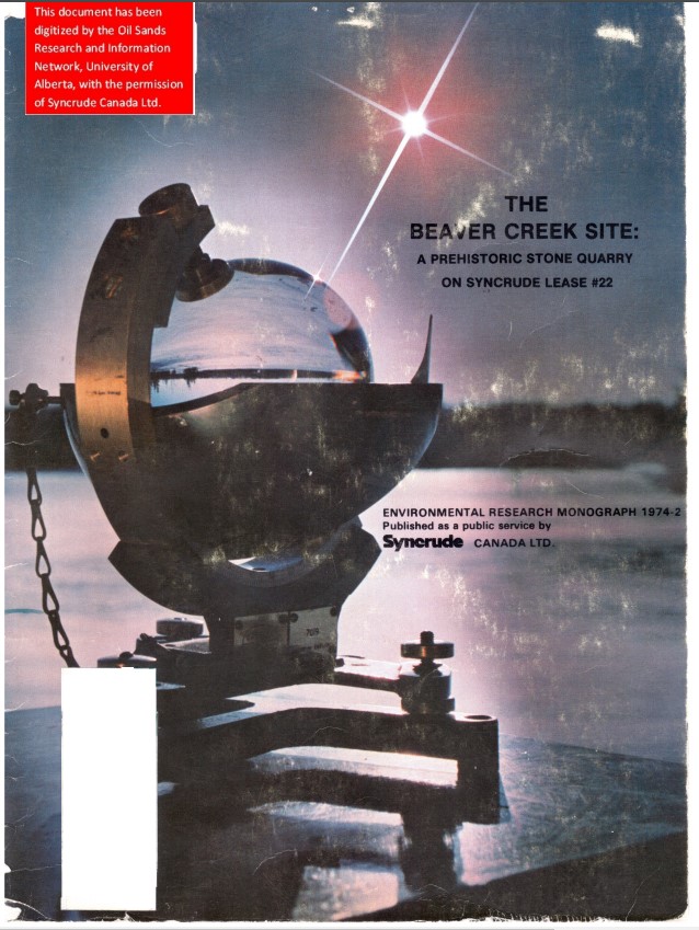
The Beaver Creek site: A Prehistoric Stone Quarry on Syncrude Lease #22
Resource
Archaeological reconnaissance on Syncrude Lease #17 noted that over 67% of the total stone assemblage recovered from 28 localities consists of quartzite derived from the Beaver Creek Quarry
The Biophysical Climate Mitigation Potential of Boreal Peatlands During the Growing Season
Resource
Peatlands and forests cover large areas of the boreal biome and are critical for global climate regulation. They also regulate regional climate through heat and water vapour exchange with the...
The Habitat of Syncrude Tar Sands Lease #17: An Initial Evaluation
Resource
Syncrude Canada Ltd. Lease 17 is located in the boreal mixedwood forest ecosystem. Twelve terrestrial and aquatic habitat types exist

The Hydrology of Lease 17: A Report of Studies Completed in the Year 1973
Resource
Flood frequency prediction for Syncrude Lease 17 is necessary for both mining activities and environmental protection. Flood frequency curves can be derived from one year’s local data

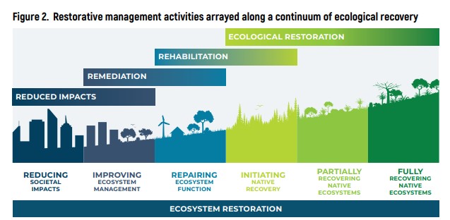
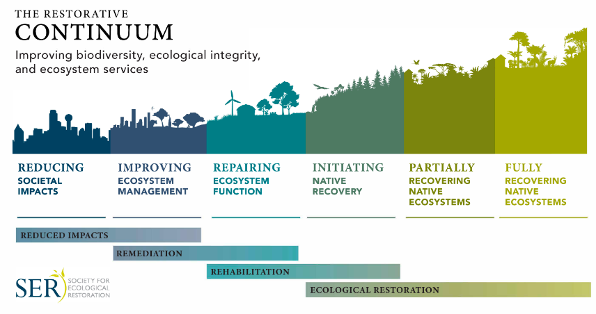
The Restorative Continuum
Resource
The Restorative Continuum includes a range of activities and interventions that can improve environmental conditions and reverse ecosystem degradation and landscape fragmentation. The continuum...
The Scale of Effect of Landscape Context Varies with the Species’ Response Variable Measured
Resource
Abstract: Context To detect an effect of landscape context on a species’ response, the landscape variables need to be measured within the appropriate distance from the species’ response, i.e. at the...
The Spatial Scale of a Species’ Response to the Landscape Context Depends on which Biological Response You Measure
Resource
This resource is available on an external database and may require a paid subscription to access it. It is included on the CCLM to support our goal of capturing and sharing the breadth of all...

Toxicity of Saline Groundwater from Syncrude's Lease 17 to Fish and Benthic Macroinvertebrates
Resource
Study designed to determine whether groundwater from the mine area is toxic and, if so, the concentrations at which this toxicity is expressed. Species, including fish and aquatic insects was tested

"Two-Eyed Seeing": An Indigenous Framework to Transform Fisheries Research and Management
Resource
Increasingly, fisheries researchers and managers seek or are compelled to “bridge” Indigenous knowledge systems with Western scientific approaches to understanding and governing fisheries. Here, we...
Use of Three-dimensional Topography as a Tool for Closure Integration at Syncrude Canada Ltd.’s Mildred Lake and Aurora North Leases
Resource
The focus of this paper is the development of a physically sound three-dimensional model of the final closure landscape for the 2011 Life of Mine Closure submission

Vegetation and Forest Productivity Syncrude Lease 22
Resource
Eleven major vegetation types were identified and are mapped at a scale of 1:20 000 on the eastern portion of Syncrude Lease 17.
