
Search Results
Displaying:
1 - 20 of 28
Canadian Wetland Inventory Activities in the Prairie and Boreal Regions of Canada
Event
Event Date and Time
August 30th, 2023 at 2:00pm EST to August 30th, 2023 at 3:00pm EST
Contact
Organization
The Wetland Mapping Consortium (WMC), founded in 2008, is an interdisciplinary group of wetland scientists and managers interested in mapping and monitoring wetlands with remotely sensed images and/or...

Cross-Scale Controls on Carbon Emissions from Boreal Forest Megafires
Resource
This resource is available on an external database and may require a paid subscription to access it. It is included on the CCLM to support our goal of capturing and sharing the breadth of all...

Demand for Nonprovisioning Ecosystem Services as a Driver of Change in the Canadian Boreal Zone
Resource
The Canadian boreal zone provides ecosystem services from local to global scales. Either directly or indirectly, demands for these services have and will continue to serve as drivers of change in the...
Digging Into Canadian Soils - An Introduction to Soil Science
Resource
Written entirely by members of the Canadian Society of Soil Science, "Digging into Canadian Soils: An Introduction to Soil Science" provides an introduction to the core disciplines of soil science...

Global Water Futures
Project
Organization:
Global Water Futures: Solutions to Water Threats in an Era of Global Change is a University of Saskatchewan-led research program that is funded in part by a $77.8-million grant from the Canada First...
Governance as a Driver of Change in the Canadian Boreal Zone
Resource
The Canadian boreal forest is primarily public land, owned and managed by provincial governments on behalf of the public interest. Boreal forest governance consists of a complex patchwork of federal...
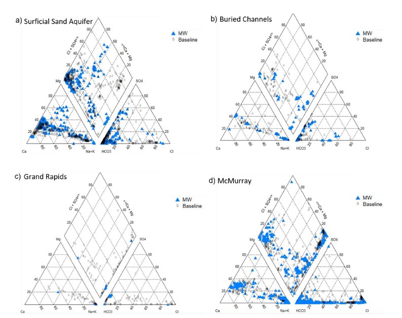
Groundwater Monitoring Near Oil Sands Development: Insights From Regional Water Quality Datasets in the Alberta Oil Sands Region (AOSR)
Resource
Groundwater quality data for the AOSR are compiled and interpreted to provide information on regional water quality to inform groundwater monitoring and land use planning. A database of 546 water...

Groundwater Monitoring Near Oil Sands Development: Insights from Regional Water Quality Datasets in the Alberta Oil Sands Region (AOSR)
Resource
Groundwater quality data for the AOSR are compiled and interpreted to provide information on regional water quality to inform groundwater monitoring and land use planning. A database of 546 water...
Hydrological Functions of a Peatland in a Boreal Plains Ecosystem
Resource
This resource is available on an external database and may require a paid subscription to access it. It is included on the CCLM to support our goal of capturing and sharing the breadth of all...
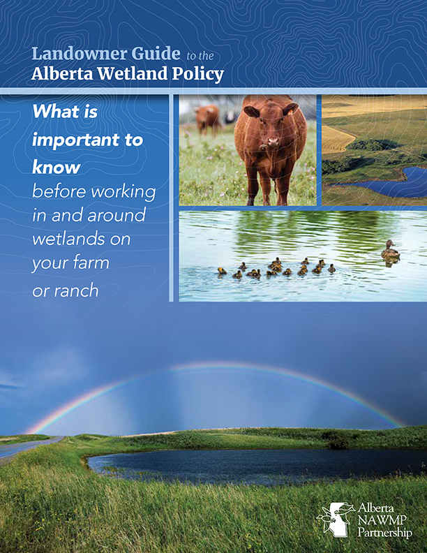
Landowner Guide to the Alberta Wetland Policy
Resource
The Landowner Guide to the Alberta Wetland Policy helps landowners understand their rights and responsibilities when working in and around wetlands on their farm or ranch under Alberta’s Wetland...

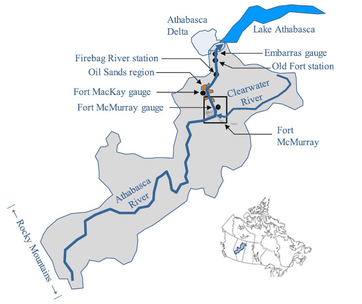
Modelling Transverse Mixing of Sediment and Vanadium in a River Impacted by Oil Sands Mining Operations
Resource
A novel, quasi-two-dimensional surface water-quality modelling approach is presented in which the model domain can be discretised in two dimensions, but a one-dimension solver can still be applied to...
NEW GUIDE: Alberta NAWMP releases the Landowner Guide to the Alberta Wetland Policy
News
Organization
The Landowner Guide to the Alberta Wetland Policy helps landowners understand their rights and responsibilities when working in and around wetlands on their farm or ranch under Alberta’s Wetland...
Open-Source Based Geo-Platform to Support Management of Wetlands and Biodiversity in Quebec
Resource
This resource is available on an external database and may require a paid subscription to access it. It is included on the CCLM to support our goal of capturing and sharing the breadth of all...