
Search Results
Displaying:
1 - 8 of 8
COSEWIC Assessment and Status Report on the Caribou (Rangifer tarandus), Barren-ground Population in Canada - 2016
Resource
The 2016 assessment report on barren-ground caribou prepared by the Committee on the Status of Endangered Species in Canada (COSEWIC). It is a long, thorough and quite technical overview. It resulted...

COSEWIC Assessment and Status Report on the Caribou (Rangifer tarandus) Dolphin and Union population in Canada 2017
Resource
The Committee on the Status of Endangered Wildlife in Canada (COSEWIC) assesses the national status of wild species, subspecies, varieties, or other designatable units that are considered to be at...
COSEWIC Assessment and Status Report on the Peary Caribou Rangifer tarandus pearyi in Canada
Resource
A 2015 assessment and status report on Peary caribou from the Committee on the Status of Endangered Wildlife in Canada (COSEWIC). This resource and others can be found on the Northern Caribou Canada...

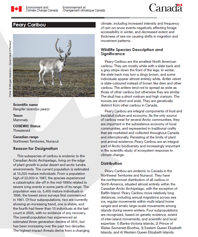
Fact Sheet: Peary Caribou
Resource
A 2015 three-page fact sheet on Peary caribou produced by the Canadian government. This resource and others can be found on the Northern Caribou Canada website. To find more related resources click...
First Nations Species at Risk Dialogues
Event
Event Date and Time
March 2nd, 2022 at 9:30am PST to March 9th, 2022 at 10:00am PST
Organization
The IISAAK OLAM Foundation and the Assembly of First Nations (AFN) are inviting all First Nations persons who have experience with monitoring, harvesting, and managing species at risk (SAR) and...

Setting a Foundation for Indigenous Knowledge Systems-guided Boreal Caribou (tǫdzı) Conservation Planning in the Western Boreal Region of Canada: A Systematic Map Protocol
Resource
Abstract In recent years, researchers have increasingly recognized the need to bridge Western and Indigenous knowledge systems to strengthen research in wildlife conservation. Historically, this arena...
The Third Generation of Pan-Canadian Wetland Map at 10 m Resolution Using Multisource Earth Observation Data on Cloud Computing Platform
Resource
Development of the Canadian Wetland Inventory Map (CWIM) has thus far proceeded over two generations, reporting the extent and location of bog, fen, swamp, marsh, and water wetlands across the country...
