
Search Results
Displaying:
1 - 11 of 11
Can Plant or Lichen Natural Abundance 15N Ratios Indicate the Influence of Oil Sands N Emissions on Bogs?
Resource
The 140,329 km 2 Athabasca Oil Sands Administrative Area (OSAA), which contains 8982 km 2 of bogs. Since the late 1970s, N emissions from oil sands development in the OSAA have steadily increased...

CEMA Resources Available Online
News
The Cumulative Environmental Management Association (CEMA) was a leading multi-stakeholder group operating in the heart of Canada’s boreal forest - the Regional Municipality of Wood Buffalo, Alberta...
COSEWIC Assessment and Status Report on the Caribou (Rangifer tarandus), Barren-ground Population in Canada - 2016
Resource
The 2016 assessment report on barren-ground caribou prepared by the Committee on the Status of Endangered Species in Canada (COSEWIC). It is a long, thorough and quite technical overview. It resulted...

COSEWIC Assessment and Status Report on the Caribou (Rangifer tarandus) Dolphin and Union population in Canada 2017
Resource
The Committee on the Status of Endangered Wildlife in Canada (COSEWIC) assesses the national status of wild species, subspecies, varieties, or other designatable units that are considered to be at...
COSEWIC Assessment and Status Report on the Peary Caribou Rangifer tarandus pearyi in Canada
Resource
A 2015 assessment and status report on Peary caribou from the Committee on the Status of Endangered Wildlife in Canada (COSEWIC). This resource and others can be found on the Northern Caribou Canada...

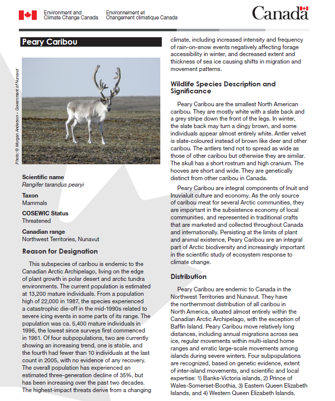
Fact Sheet: Peary Caribou
Resource
A 2015 three-page fact sheet on Peary caribou produced by the Canadian government. This resource and others can be found on the Northern Caribou Canada website. To find more related resources click...
Research as Reciprocity: Northern Cree Community-Based and Community-Engaged Research on Wild Food Contamination in Alberta’s Oil Sands Region
Resource
In this paper, the author suggests that it is possible to participate in research as an act of reciprocity; when a community asks a researcher for help on a specific topic, the application of that...
Scott Ketcheson
Contact
Organization
Position Title
Assistant Professor, Canada Research Chair in Hydrological Sustainability
The Third Generation of Pan-Canadian Wetland Map at 10 m Resolution Using Multisource Earth Observation Data on Cloud Computing Platform
Resource
Development of the Canadian Wetland Inventory Map (CWIM) has thus far proceeded over two generations, reporting the extent and location of bog, fen, swamp, marsh, and water wetlands across the country...

Webinar - Towards Understanding the Influence of Headwater Catchments on Water Availability in the Athabasca River Basin
Resource
This presentation highlights the importance of northern Alberta’s “mountains” and wetlands on sustaining water flows in local streams and regional rivers in the Athabasca River Basin.
