
Search Results
Displaying:
121 - 140 of 159
The Biophysical Climate Mitigation Potential of Boreal Peatlands During the Growing Season
Resource
Peatlands and forests cover large areas of the boreal biome and are critical for global climate regulation. They also regulate regional climate through heat and water vapour exchange with the...

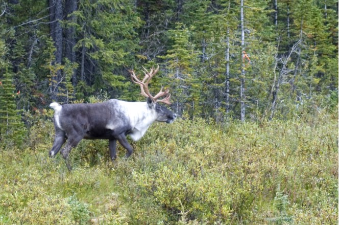
The Direct and Habitat-mediated Influence of Climate on the Biogeography of Boreal Caribou in Canada
Resource
Effective species conservation efforts require insight into whether a species’ extent of occurrence may shift due to changing climate, habitat loss, or both. The extent of occurrence of the threatened...

The Distribution of Nutrients and Organic Matter in Native Mountain Grasslands and Reclaimed Coal-mined Areas in Southeastern B.C.
Resource
The study's purpose is to assess the nutrient self-sufficiency of five-year-old reclaimed areas in montane and subalpine environments. Adjacent, undisturbed native grasslands were also studied for...

The Effects of Maternal Penning on the Movement Ecology of Mountain Caribou
Resource
This resource is available on an external database and may require a paid subscription to access it. It is included on the CCLM to support our goal of capturing and sharing the breadth of all...
The Effects of Variable Retention Harvesting on Caribou Terrestrial Forage Lichens
Resource
Northern caribou depend on terrestrial lichens as a primary source of food during winter. This paper illustrates how changes in harvesting intensity affect terrestrial lichen abundance, species...
The Multisource Vegetation Inventory (MVI): A Satellite-Based Forest Inventory for the Northwest Territories Taiga Plains
Resource
Wall-to-wall 30 m raster maps of broad forest type, stand height, crown closure, stand volume, total volume, aboveground biomass, and stand age were created for a ~400,000 km2 area, validated with independent data, and generalized into a polygon GIS layer resembling a traditional FI map. The MVI project showed that a reasonably accurate FI map for large, remote, predominantly non-inventoried boreal regions can be obtained at a low cost by combining limited field data with remote sensing data from multiple sources.
The Spatial Patterns of Anthropogenic Disturbance in the Western Canadian Boreal Forest Following Oil and Gas Development
Resource
Resource development can have significant consequences for the distribution of vegetation cover and for species persistence. Modelling changes to anthropogenic disturbance regimes over time can...
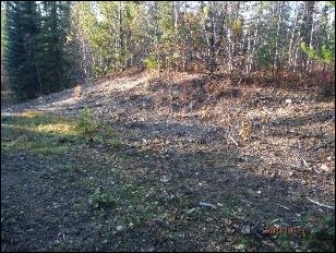
“These Trees Have Stories to Tell”: Linking Dënesǫ́łıné Oral History of Caribou Use with Trample Scar Frequency on Black Spruce Roots at Ɂedacho Kué
Resource
This paper describes linkages between knowledge derived from Dënesǫ́łıné oral history and quantitative dendroecological analysis of trample scars on black spruce ( Picea mariana) root samples...
Theses - University of British Columbia
Project
Organization:
The UBC Theses and Dissertations collection promotes open and comprehensive access to a significant body of unique knowledge created by graduate students to support further research and for private...
Trophic Consequences of Terrestrial Eutrophication for a Threatened Ungulate
Resource
Conservation actions directed at the proximate cause of caribou decline have been more successful in the near term than those directed further along the trophic chain.
"Two-Eyed Seeing": An Indigenous Framework to Transform Fisheries Research and Management
Resource
Increasingly, fisheries researchers and managers seek or are compelled to “bridge” Indigenous knowledge systems with Western scientific approaches to understanding and governing fisheries. Here, we...
Using Perceptions as Evidence to Improve Conservation and Environmental Management
Resource
The conservation community is increasingly focusing on the monitoring and evaluation of management, governance, ecological, and social considerations as part of a broader move toward adaptive...
Video - Assessment of forest attributes using airborne and terrestrial LiDAR
Resource
This presentation discusses the different ways that LiDAR data can be effectively used in forestry management applications.

Video - Barren-ground Caribou Surveys - English
Resource
A 1':25" 2018 video with subtitles from the Government of the Northwest Territories showing and explaining the aerial surveys of barren-ground caribou in 2018. Related Herds: Bathurst, Bluenose East...
Video - Boots on the Ground Caribou Monitoring Program
Resource
A 2':49" 2018 video that talks about the "boots on the ground" program to monitor Bathurst caribou, a partnership between the Tli'cho government and the Government of the Northwest Territories...
Video - Boreal Caribou Calving Events in the Dehcho, Northwest Territories
Resource
At the 14th North American Caribou Workshop held in September 2012, Nick Larter presented on research related to identifying calving events amongst the boreal caribou in the Dehcho region.

Video - Ecological Resiliency
Resource
This introductory lecture at the seminar on Resiliency of Reclaimed Boreal Forest Landscapes discusses the two sides of the coin, ecosystem resilience and engineering resilience.

Video - How We Count Caribou: Calving Ground Photo Survey
Resource
This video explains the Calving Ground Photo Survey method used to count Bathurst and Bluenose-East caribou. Caribou are valued by Northerners as a very important part of their culture, and part of...

Video - The TRIA Project: Genomics of the Mountain Pine Beetle system
Resource
This presentation discusses the TRIA Project and it's use related to mountain pine beetle populations, physiological genomics and risk modeling.
