Land Management Search Results
Resource
Authors
Andrea Hanke
Monica Angohiatok
Lisa-Marie Leclerc
Cindy Adams
Susan Kutz
Resource Date:
December
2021
The Dolphin and Union (DU) caribou herd ( Rangifer tarandus groenlandicus x pearyi), locally referred to as Island caribou, is a unique and at-risk ecotype of caribou that ranges on Victoria Island...
Resource
Authors
Kevin Smith
Christopher Smith
Silvie Forest
Alain Richard
This guide provides an in-depth look at Ducks Unlimited Canada's (DUC) remote-sensing satellite mapping efforts and the development of the DUC enhanced wetland classification system.
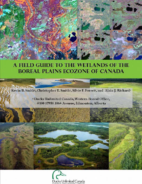
Resource
Authors
Ungava Peninsula Caribou Aboriginal Round Table
The Indigenous Peoples of Ungava self-organized into the Ungava Peninsula Caribou Aboriginal Round Table (“UPCART” or “the Round Table”) in early 2013. For the first time in human history the Peoples...
Resource
Authors
Landmark Resource Management Ltd.
Boreal caribou ( Rangifer tarandus caribou) are traditionally a highly significant species to ADKFN and the species is currently listed as ‘threatened’ under Canada’s Species at Risk Act (SARA). As a...
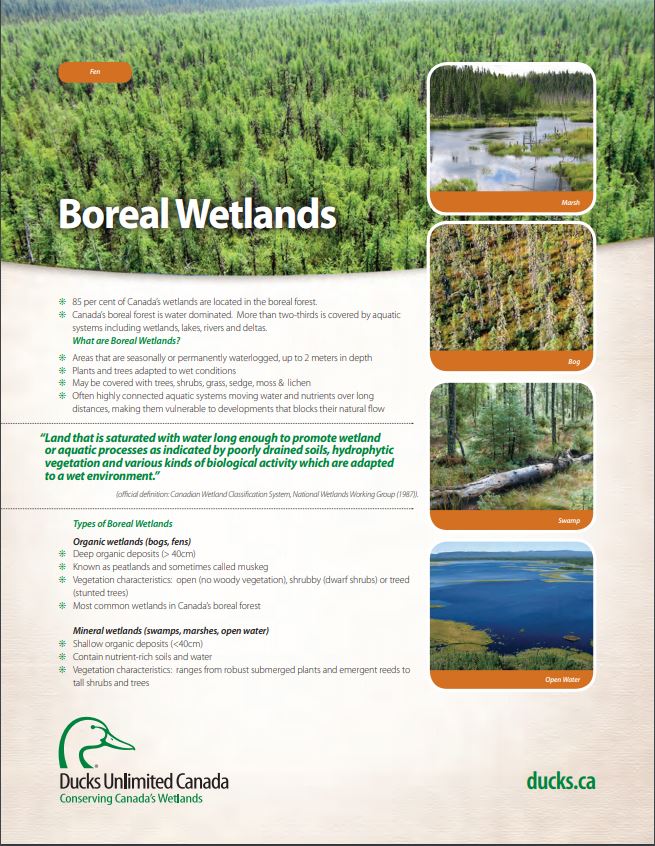
Resource
These fact sheets highlight plant, soil, and water indicators and key ecological benefits of each of the five major wetlands types.
Resource
Authors
Amy Christianson
Colin Sutherland
Faisal Moola
Noémie Bautista
David Young
Heather MacDonald
Indigenous perspectives have often been overlooked in fire management in North America. With a focus on the boreal region of North America, this paper provides a review of the existing literature...
Resource
Authors
Scott McNay
Clayton Lamb
Line Giguere
Sara Williams
Hans Martin
Glenn Sutherland
Mark Hebblewhite
Resource Date:
March
2022
Recovering endangered species is a difficult and often controversial task that challenges status-quo land uses. Southern Mountain caribou are a threatened ecotype of caribou that historically ranged...
Resource
Authors
Whaèhdôö Nàowoò Kö Dogrib Treaty 11 Council
A long 2002 paper on Dogrib (Tlicho) place names. It discusses how caribou are embedded in many place names. This resource and others can be found on the Northern Caribou Canada website. To find more...
Resource
Ducks Unlimited Canada has been leading the effort to provide detailed and accurate wetland maps for large areas of the western boreal forest. These mapping products have become the cornerstone of DUC...
Resource
A 72-pge 2015 report by the Gwich'in Social and Cultural Institute on Gwich’in Traditional Knowledge of the Bluenose-West Caribou herd. This resource and others can be found on the Northern Caribou...
Resource
Resource Date:
March
2011
... conducted 20 interviews with holders of Gwich’in traditional knowledge and searched the digital archives of GSCI for relevant primary and secondary data to obtain TK about [woodland caribou].
Resource
Authors
Hanna Blåheda
Miguel San Sebastián
In 2006, a British mining company started the process of extracting ore from Gállok/Kallak, in Swedish Sápmi. These grounds are used all year round for reindeer herding by the Sámi community...
Resource
Authors
Justine Townsend
Faisal Moola
Mary-Kate Craig
Resource Date:
November
2020
Nature-based solutions (NbS) to climate change mitigation—such as ecosystem protection or conservation, improved forest management practices, as well as afforestation—can significantly reduce global...
Resource
Authors
Anne McIntosh
Bonnie Drozdowski
Dani Degenhardt
Chris Powter
Christina Small
John Begg
Dan Farr
Arnold Janz
Randi Lupardus
Delinda Ryerson
Jim Schiek
We developed a scientifically robust and financially sustainable monitoring protocol to enable a consistent assessment of ecological recovery at reclaimed industrial wellsites in forested lands
Resource
Authors
Jeffrey Speller
Véronique Forbes
Resource Date:
March
2022
This article explores uses of peat bogs and associated plants and other resources by drawing on the published ethnobotanical and archeological literature pertaining to Indigenous groups that lived and...
Resource
Resource Date:
September
2023
Although peatlands cover only 3% of the world's land, they store about twice as much carbon as in the biomass of all the world's forests combined. Thus, they are incredibly important especially for...
Resource
Authors
Laura Chasmer
Edberto Moura Lima
Craig Mahoney
Chris Hopkinson
Joshua Montgomery
Danielle Cobbaert
Resource Date:
August
2021
Bi-temporal LiDAR data used to identify correspondence between density of anthropogenic disturbances, wetland shape complexity and changes in vegetation height within >1800 wetlands near Fort McKay
Resource
Authors
José Gérin-Lajoie
Alain Cuerrier
Laura Siegwart Collier
In full colour with photos of the 145 contributing Inuit elders, “The Caribou Taste Different Now” grounds the discussions, debates, and discourses about climate change to material and everyday life in the contemporary Canadian Arctic.
Resource
Authors
Rachel Hovel
Jeremy Brammer
Emma Hodgson
Amy Amos
Trevor Lantz
Chanda Turner
Tracey Proverbs
Sarah Lord
Rapid environmental change in the Arctic elicits numerous concerns for ecosystems, natural resources, and ways of life. Robust monitoring is essential to adaptation and management in light of these...
Resource
Authors
Guillermo Castilla
Ronald Hall
Rob Skakun
Michelle Filiatrault
André Beaudoin
Michael Gartrell
Lisa Smith
Kathleen Groenewegen
Chris Hopkinson
Jurjen van der Sluijs
Resource Date:
February
2022
Wall-to-wall 30 m raster maps of broad forest type, stand height, crown closure, stand volume, total volume, aboveground biomass, and stand age were created for a ~400,000 km2 area, validated with independent data, and generalized into a polygon GIS layer resembling a traditional FI map. The MVI project showed that a reasonably accurate FI map for large, remote, predominantly non-inventoried boreal regions can be obtained at a low cost by combining limited field data with remote sensing data from multiple sources.