
Search Results
Displaying:
1 - 20 of 47
A Regional-Scale Index for Assessing the Exposure of Drinking-Water Sources to Wildfires
Resource
Recent human-interface wildfires around the world have raised concerns regarding the reliability of freshwater supply flowing from severely burned watersheds. Degraded source water quality can often...

A Synthesis of Three Decades of Eco-Hydrological Research at Scotty Creek, NWT, Canada
Resource
Scotty Creek, Northwest Territories (NWT), Canada, has been the focus of eco-hydrological research for nearly three decades. Over this period, field and modelling studies have generated new insights...
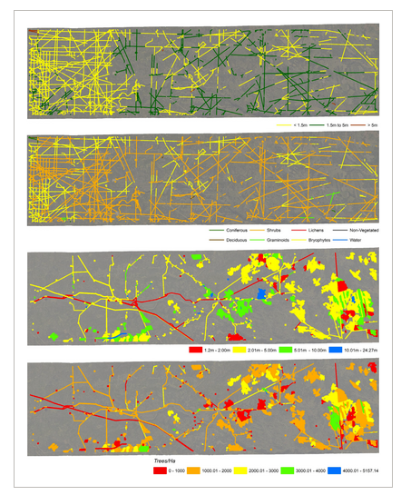
Applying Remote Sensing for Large-landscape Problems: Inventorying and Tracking Habitat Recovery for a Broadly Distributed Species At Risk
Resource
Abstract Anthropogenic habitat alteration is leading to the reduction of global biodiversity. Consequently, there is an imminent need to understand the state and trend of habitat alteration across...

Applying Remote Sensing for Large-landscape Problems: Inventorying and Tracking Habitat Recovery for a Broadly Distributed Species At Risk
Resource
Anthropogenic habitat alteration is leading to the reduction of global biodiversity. Consequently, there is an imminent need to understand the state and trend of habitat alteration across broad areas...

Canadian Wetland Inventory using Google Earth Engine: The First Map and Preliminary Results
Resource
Although wetlands provide valuable services to humans and the environment and cover a large portion of Canada, there is currently no Canada-wide wetland inventory based on the specifications defined...

Community-level Modelling of Boreal Forest Mammal Distribution in an Oil Sands Landscape
Resource
This resource is available on an external database and may require a paid subscription to access it. It is included on the CCLM to support our goal of capturing and sharing the breadth of all...
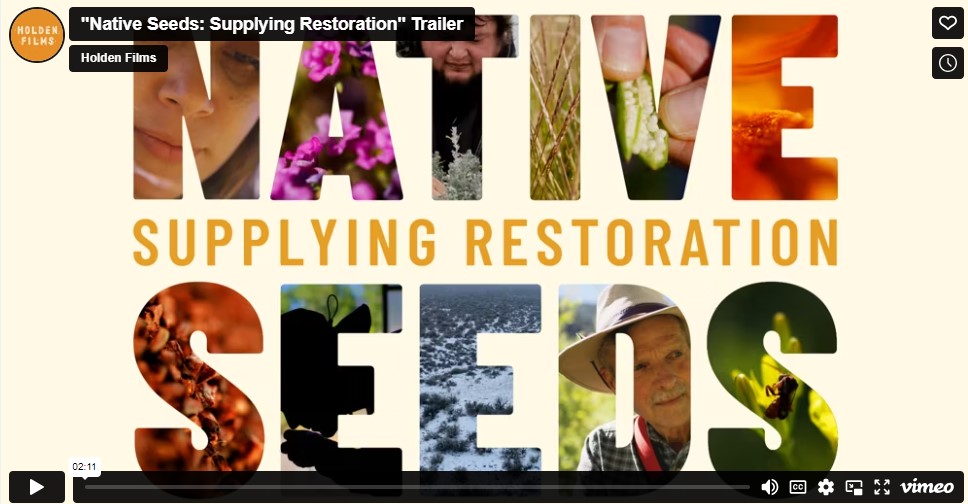
Documentary Series Explores Urgent Efforts to Grow the Native Seed Supply Chain in the Western US
News
Organization
The International Network for Seed-based Restoration, a thematic section of the Society for Ecological Restoration is releasing a nine-part video series this summer about the native seed supply chain...
Examining Drivers of Post-Fire Seismic Line Ecotone Regeneration in a Boreal Peatland Environment
Resource
Seismic lines are the dominant anthropogenic disturbance in the boreal forest of the Canadian province of Alberta, fragmenting over 1900 km 2 of peatland areas and accounting for more than 80% of all...
Increasing Contributions of Peatlands to Boreal Evapotranspiration in a Warming Climate
Resource
The response of evapotranspiration (ET) to warming is of critical importance to the water and carbon cycle of the boreal biome, a mosaic of land cover types dominated by forests and peatlands. The...
Monitoring Procedures for Wellsite, In-Situ Oil Sands and Coal Mine Reclamation in Alberta – December 2014 Update
Resource
Scope of the project is to develop a geomatics-based monitoring system to support the Government of Alberta’s efforts for monitoring reclamation success. Software will support decision making process

Recreational Trail Impacts on the Plant Communities of Castle and Castle Wildland Provincial Parks in Southern Alberta
Resource
I measured the effect of recreational trails on plant species richness, community composition, and the presence of exotic and rare species in the Castle Provincial Parks of Alberta, Canada, by...

Seismic Line Impacts on Proximal Boreal Forest and Wetland Environments in Alberta
Resource
This resource is available on an external database and may require a paid subscription to access it. It is included on the CCLM to support our goal of capturing and sharing the breadth of all...

Shortening Fire Return Interval Predisposes West-Central Canadian Boreal Peatlands to More Rapid Vegetation Growth and Transition to Forest Cover
Resource
Climate change in northern latitudes is increasing the vulnerability of peatlands and the riparian transition zones between peatlands and upland forests (referred to as ecotones) to greater frequency...

Shrub Changes with Proximity to Anthropogenic Disturbance in Boreal Wetlands Determined Using Bi-temporal Airborne LiDAR in the Oil Sands Region, Alberta Canada
Resource
Bi-temporal LiDAR data used to identify correspondence between density of anthropogenic disturbances, wetland shape complexity and changes in vegetation height within >1800 wetlands near Fort McKay
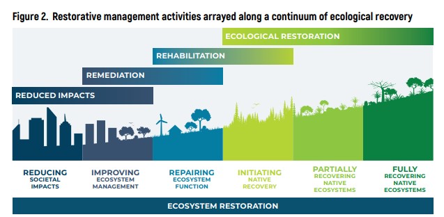
Standards of Practice to Guide Ecosystem Restoration: A Contribution to the United Nations Decade on Ecosystem Restoration. Summary Report
Resource
The United Nations Decade on Ecosystem Restoration 2021–2030 (hereafter “UN Decade”) recognizes the critical need to prevent, halt and reverse the degradation of the world’s ecosystems. Effective...
The Biophysical Climate Mitigation Potential of Boreal Peatlands During the Growing Season
Resource
Peatlands and forests cover large areas of the boreal biome and are critical for global climate regulation. They also regulate regional climate through heat and water vapour exchange with the...