
Search Results
Displaying:
1 - 20 of 20
Alberta Mine Reclamation and Abandonment Requirements
Resource
Paper reviews ERCB processes for mine regulation, Board decisions relating to reclamation and abandonment, and new regulations for tailings at oil sands mining operations.

Alberta Watercourse Crossing Collaborative Fall 2021 Webinar Series
Resource
The Alberta Watercourse Crossing Collaborative held a Fall 2021 Webinar Series to fulfill its objectives around information transfer, education and training. Webinars included: Alberta Watercourse...
Biogeochemical Response to Vegetation and Hydrologic Change in an Alaskan Boreal Fen Ecosystem
Resource
Boreal peatlands store approximately one third of the earth’s terrestrial carbon, locked away in currently waterlogged and frozen conditions. Peatlands of boreal and arctic ecosystems are affected...

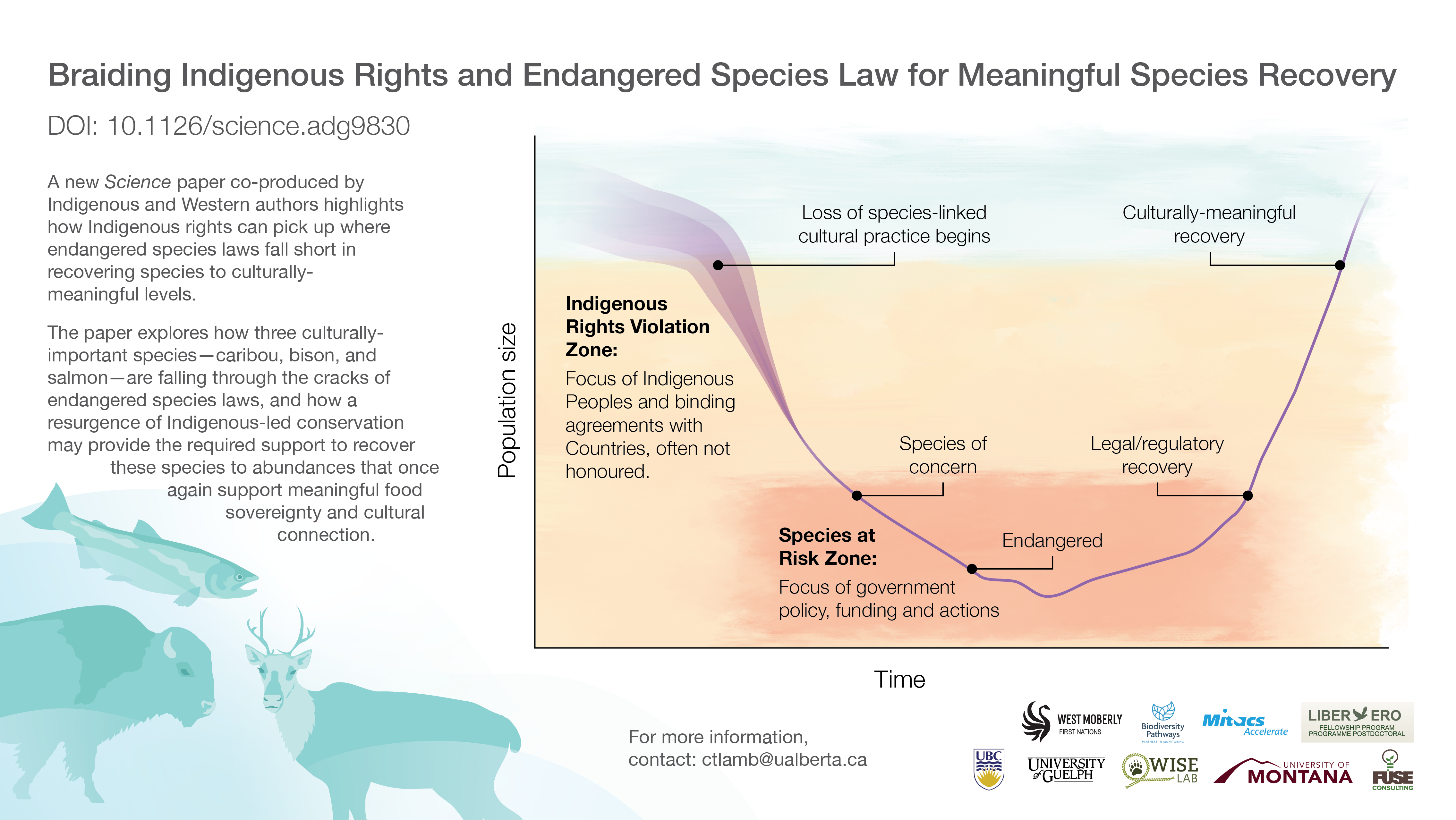
Braiding Indigenous Rights and Endangered Species Law
Resource
Endangered species laws effectively prevent species extinction but fall short in restoring abundance for culturally important species. Legal agreements between Indigenous peoples and countries...

Braiding Indigenous Rights and Endangered Species Law for Meaningful Species Recovery - Infographic
Resource
A new Science paper co-produced by Indigenous and Western authors highlights how Indigenous rights can pick up where endangered species laws fall short in recovering species to culturally-meaningful...
Community-level Modelling of Boreal Forest Mammal Distribution in an Oil Sands Landscape
Resource
This resource is available on an external database and may require a paid subscription to access it. It is included on the CCLM to support our goal of capturing and sharing the breadth of all...
Habitat Restoration Across the Klinse-Za Caribou Herd Range
Project
The Klinse-Za herd area, located between Mackenzie, Chetwynd and the Peace Arm of Williston reservoir, used to support a herd of almost 200 caribou as recently as 1995 and was said to be so numerous...

Indigenous-led Conservation: Pathways to Recovery for the Nearly Extirpated Klinse-Za Mountain Caribou
Resource
Indigenous Peoples around the northern hemisphere have long relied on caribou for subsistence, ceremonial, and community purposes. Unfortunately, despite recovery efforts by Federal and Provincial...
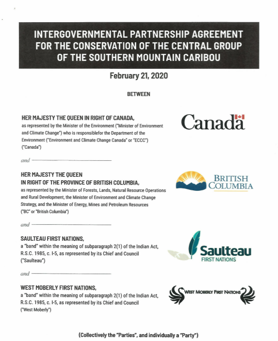
Intergovernmental Partnership Agreement for the Conservation of the Central Group of the Southern Mountain Caribou
Resource
This Agreement sets out the parties Shared Recovery Objective of immediately stabilizing and expeditiously growing the population of the Central Group (of Southern Mountain Caribou) to levels that are...
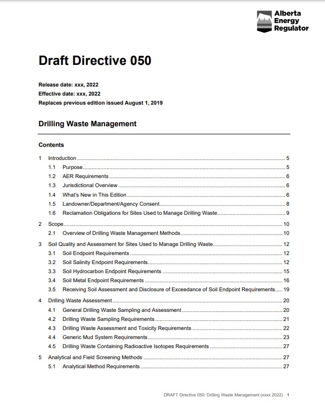
Invitation for Feedback on Revisions to Alberta Energy Regulator Directive 050
News
Organization
The Alberta Energy Regulator is seeking feedback on updates to Directive 050: Drilling Waste Management. The proposed changes reduce the regulatory burden throughout the life cycle of drilling waste...
Klinse-Za Caribou Recovery
Project
Contact
Organization:
Project Description: In response to recent and dramatic declines of mountain caribou populations within their traditional territory, West Moberly First Nations and Saulteau First Nations (collectively...

Managing Regional Cumulative Effects of Oil Sands Development in Alberta, Canada
Resource
This resource is available on an external database and may require a paid subscription to access it. It is included on the CCLM to support our goal of capturing and sharing the breadth of all...

Naomi Owens-Beek
Contact
Peat Loss Collocates with a Threshold in Plant–Mycorrhizal Associations in Drained Peatlands Encroached by Trees
Resource
Drainage-induced encroachment by trees may have major effects on the carbon balance of northern peatlands, and responses of microbial communities are likely to play a central mechanistic role. We...

The Alberta Oil Sands
Resource
Overview of the oil sands, current commercial developments, experimental work, an overview of Fort McMurray and the role of government agencies in development and management of oil sands.

The Third Generation of Pan-Canadian Wetland Map at 10 m Resolution Using Multisource Earth Observation Data on Cloud Computing Platform
Resource
Development of the Canadian Wetland Inventory Map (CWIM) has thus far proceeded over two generations, reporting the extent and location of bog, fen, swamp, marsh, and water wetlands across the country...
Video - Surficial geology mapping in northern Alberta using LiDAR
Resource
This presentation describes the ways that LiDAR has helped some of the challenges previously encountered in data collection for the surficial geology mapping program.

Webinar - AER OneStop Record of Site Condition (RoSC) Information Update
Event
Event Date and Time
October 11th, 2023 at 10:00am MST to October 11th, 2023 at 11:30am MST
Organization
As part of AERs ongoing engagement activities, this is a live online session delivered through Microsoft Teams that will focus on RoSC submissions under the Contamination Review for Reclamation (CRR)...