
Search Results
Displaying:
1 - 20 of 43
Braiding Indigenous Rights and Endangered Species Law
Resource
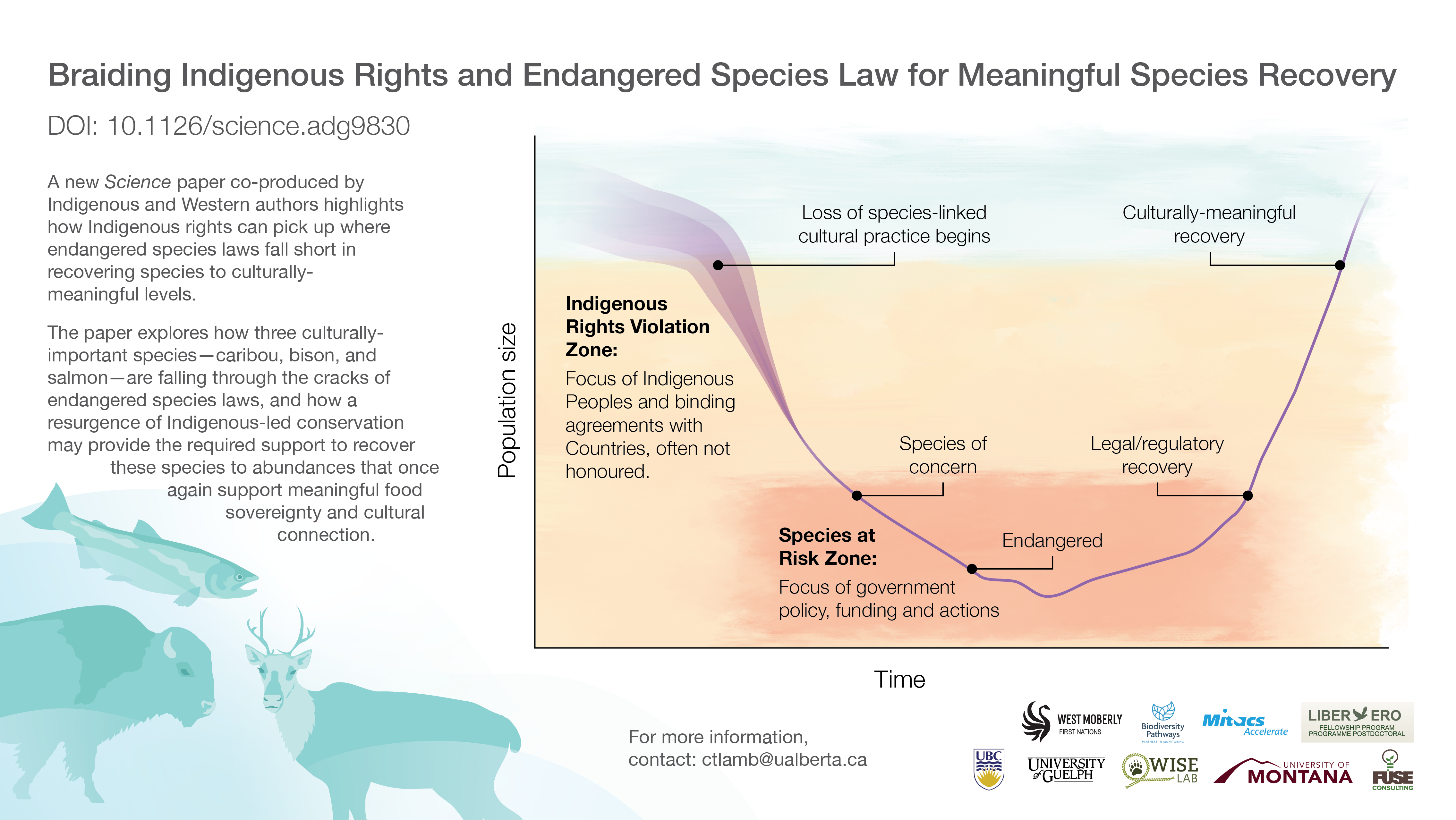
Endangered species laws effectively prevent species extinction but fall short in restoring abundance for culturally important species. Legal agreements between Indigenous peoples and countries...

Braiding Indigenous Rights and Endangered Species Law for Meaningful Species Recovery - Infographic
Resource
A new Science paper co-produced by Indigenous and Western authors highlights how Indigenous rights can pick up where endangered species laws fall short in recovering species to culturally-meaningful...
Continental Synchrony and Local Responses: Climatic Effects on Spatiotemporal Patterns of Calving in a Social Ungulate
Resource
Warming temperatures and advancing spring are affecting annual snow and ice cycles, as well as plant phenology, across the Arctic and boreal regions. These changes may be linked to observed population...
Factors Contributing to the Cultural and Spatial Variability of Landscape Burning by Native Peoples of Interior Alaska
Project
Organization:
In this project, a multidisciplinary research team, together with native community partners, analyzed patterns of human-fire interaction over time and then stratified the predominant anthropogenic...

Factors Contributing to the Cultural and Spatial Variability of Landscape Burning by Native Peoples of Interior Alaska
Resource
This article analyzes the geographical extent to which native peoples of Interior Alaska used fire to modify the landscape at the time of European contact. Although wildfire has been central to the...
Groundwater: Making the Invisible, Visible - WPACs World Water Day 2022
Event
Event Date and Time
March 22nd, 2022 at 1:00pm MST to March 22nd, 2022 at 3:00pm MST
Organization
The Watershed Planning and Advisory Councils (WPACs) of Alberta work towards the protection of water resources in our province. Collaboratively we are presenting this online World Water Day event. The...

Habitat Restoration Across the Klinse-Za Caribou Herd Range
Project
The Klinse-Za herd area, located between Mackenzie, Chetwynd and the Peace Arm of Williston reservoir, used to support a herd of almost 200 caribou as recently as 1995 and was said to be so numerous...

Indigenous-led Conservation: Pathways to Recovery for the Nearly Extirpated Klinse-Za Mountain Caribou
Resource
Indigenous Peoples around the northern hemisphere have long relied on caribou for subsistence, ceremonial, and community purposes. Unfortunately, despite recovery efforts by Federal and Provincial...
Integrating Coastal Vulnerability and Community-Based Subsistence Resource Mapping in Northwest Alaska
Project
Organization:
This project integrates physical, anthropological, and survey data to assess coastal vulnerability and to identify areas of concern for local and regional planning and environmental protection. This...
Integrating Coastal Vulnerability and Community-Based Subsistence Resource Mapping in Northwest Alaska
Resource
This resource is available on an external database and may require a paid subscription to access it. It is included on the CCLM to support our goal of capturing and sharing the breadth of all...
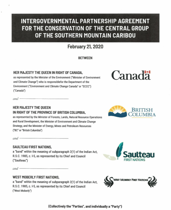
Intergovernmental Partnership Agreement for the Conservation of the Central Group of the Southern Mountain Caribou
Resource
This Agreement sets out the parties Shared Recovery Objective of immediately stabilizing and expeditiously growing the population of the Central Group (of Southern Mountain Caribou) to levels that are...
Klinse-Za Caribou Recovery
Project
Contact
Organization:
Project Description: In response to recent and dramatic declines of mountain caribou populations within their traditional territory, West Moberly First Nations and Saulteau First Nations (collectively...
Microtopography Matters: Belowground CH4 Cycling Regulated by Differing Microbial Processes in Peatland Hummocks and Lawns
Resource
This resource is available on an external database and may require a paid subscription to access it. It is included on the CCLM to support our goal of capturing and sharing the breadth of all...

Naomi Owens-Beek
Contact
The Third Generation of Pan-Canadian Wetland Map at 10 m Resolution Using Multisource Earth Observation Data on Cloud Computing Platform
Resource
Development of the Canadian Wetland Inventory Map (CWIM) has thus far proceeded over two generations, reporting the extent and location of bog, fen, swamp, marsh, and water wetlands across the country...

Video - Alberta Watershed Toolkit
Resource
This presentation describes the Alberta Watershed Toolkit as a watershed planning community space to share success stories and tools.

Video - Alberta Wetland Policy
Resource
This presentation discusses the state of wetland and peatland conservation in Alberta.

Video - Alberta's Upstream Petroleum Industry's Spill Preparedness: The Co-op Approach
Resource
This presentation describes how the Alberta oil and gas industry decided to go with a oil/gas spill cooperative rather than having individual company spill response units.

Video - Assessing agricultural practices to improve watershed management in Alberta
Resource
This presentation summarizes a 6 year project to evaluate the environmental and economic performance of agricultural BMPs to improve water quality on small watercourses in Alberta.
