
Search Results
Displaying:
21 - 40 of 54
Monitoring Procedures for Wellsite, In-Situ Oil Sands and Coal Mine Reclamation in Alberta – December 2014 Update
Resource
Scope of the project is to develop a geomatics-based monitoring system to support the Government of Alberta’s efforts for monitoring reclamation success. Software will support decision making process

Natural Climate Solutions for Canada
Resource
Alongside the steep reductions needed in fossil fuel emissions, natural climate solutions (NCS) represent readily deployable options that can contribute to Canada’s goals for emission reductions. We...

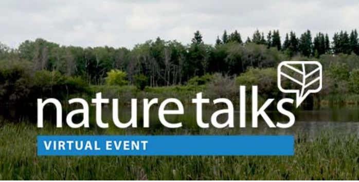
NatureTalks: Wetlands 101
Event
Event Date and Time
March 29th, 2022 at 6:00pm MST to March 29th, 2022 at 7:00pm MST
Organization
What is a wetland? Do you know how to spot one? Did you know that the health of wetlands and grasslands are connected? Wetlands aren’t simply beautiful features of a landscape; they are important to...
Recreational Trail Impacts on the Plant Communities of Castle and Castle Wildland Provincial Parks in Southern Alberta
Resource
I measured the effect of recreational trails on plant species richness, community composition, and the presence of exotic and rare species in the Castle Provincial Parks of Alberta, Canada, by...

Seismic Line Impacts on Proximal Boreal Forest and Wetland Environments in Alberta
Resource
This resource is available on an external database and may require a paid subscription to access it. It is included on the CCLM to support our goal of capturing and sharing the breadth of all...

Shortening Fire Return Interval Predisposes West-Central Canadian Boreal Peatlands to More Rapid Vegetation Growth and Transition to Forest Cover
Resource
Climate change in northern latitudes is increasing the vulnerability of peatlands and the riparian transition zones between peatlands and upland forests (referred to as ecotones) to greater frequency...

Shrub Changes with Proximity to Anthropogenic Disturbance in Boreal Wetlands Determined Using Bi-temporal Airborne LiDAR in the Oil Sands Region, Alberta Canada
Resource
Bi-temporal LiDAR data used to identify correspondence between density of anthropogenic disturbances, wetland shape complexity and changes in vegetation height within >1800 wetlands near Fort McKay

Swath of boreal forest twice the size of Toronto to be protected in northern Ontario
News
Organization
OTTAWA — The largest private land conservation project in Canadian history is unfolding in northern Ontario. The Nature Conservancy of Canada spent the last year negotiating the purchase of 1,450...
The Biophysical Climate Mitigation Potential of Boreal Peatlands During the Growing Season
Resource
Peatlands and forests cover large areas of the boreal biome and are critical for global climate regulation. They also regulate regional climate through heat and water vapour exchange with the...
The Outaouais Regions Frogs and their Role in Saving Wetland: Nature conservancy of Canada Webinar
Event
Event Date and Time
August 19th, 2021 at 1:00pm EST to August 19th, 2021 at 2:00pm EST
, QC
Organization
On Thursday, August 19 from 1 - 2 p.m. ET, a conservation biologist from the Nature Conservancy of Canada (NCC) will talk about the Outaouais region's frogs and their crucial role in saving our...

Theses - University of Lethbridge
Project
Organization:
Electronic theses from University of Lethbridge students.
Tree Species Mapping Around Reclaimed Oil and Gas Wells Sites Using Hyperspectral and Light Detection and Ranging (LiDAR) Remote Sensing
Resource
Oil and gas activities in Alberta require disturbing forested lands, among other ecosystems, in order to extract resources. Due to the number of oil and gas sites requiring reclamation, monitoring can...

Video - A multi-level classification for Boreal wetlands
Resource
This presentation discusses the need for a multi-level classification for boreal wetlands and accurate change detection.

Video - Alberta Water Extent Monitoring Pilot Study
Resource
This presentation discusses the Alberta water extent monitoring pilot study, with the goal to create a database that has the potential for implementation at a provincial level.

Video - Bathymetric LiDARs for Hydrographic Mapping
Resource
This presentation talks about Bathymetric LiDARs for Hydrographic Mapping with a focus on ALTM systems and data fusion.

Video - Functional Environmental Flows: A Practical Strategy for Healthy Rivers
Resource
This presentation describes how focusing on functional flows versus typical water conservation management could improve aquatic in-stream ecosystems while meeting current water allocations.

Video - LiDAR & Water Resources Applications
Resource
Dr. Chris Hopkinson introduces a series of seven videos that covers the topic of LiDAR and its application in water resources planning and monitoring.

Video - LiDAR and LAS Tools
Resource
This presentation provides insight and understanding to how LiDAR data is used to produce digital elevation models and vegetation maps.

Video - Overview of Airborne Laser Scanning
Resource
Chris Hopkinson gives an overview of how airborne laser scanning works, what type of data is collected, and how it can be used.
