Ressources de connaissances sur les terres humides
Ressource
On 19th June 2023, BirdWatch Ireland hosted an online presentation by Dr. Flo Renou Wilson, peatland expert from University College Dublin. Participants included members of different organisations...
Ressource
Our Nature talk on Tuesday, July 4th, featured Rachel Kendall and her work surrounding the forested wetlands of Nova Scotia. Rachel loves exploring and gaining new understandings of how plants, soil...
Ressource
Author(s)
Jason Clark
Ken Tape
Latha Baskaran
Clayton Elder
Charles Miller
Kimberley Miner
Jonathan O'Donnell
Benjamin Jones
Beaver engineering in the Arctic tundra induces hydrologic and geomorphic changes that are favorable to methane (CH 4) production. Beaver-mediated methane emissions are driven by inundation of...
Ressource
Author(s)
Mariano Feldman
Marc Mazerolle
Louis Imbeau
Nicole Fenton
As resource extraction moves north across the globe, wetland ecosystems in Canada are increasingly degraded because of disturbances associated with anthropic activities, including timber harvesting...
Ressource
Author(s)
Lauren Thompson
McKenzie Kuhn
Johanna Winder
Lucas Braga
Ryan Hutchins
Andrew Tanentzap
Vincent St. Louis
David Olefeldt
Resource Date:
January
2023
Permafrost thaw may increase the production of neurotoxic methylmercury (MeHg) in northern peatlands, but the downstream delivery of MeHg is uncertain. We quantified total mercury (THg) and MeHg...
Ressource
Author(s)
Camille Defrenne
Jessica Moore
Colin Tucker
Louis Lamit
Evan Kane
Randall Kolka
Rodney Chimner
Jason Keller
Erik Lilleskov
Drainage-induced encroachment by trees may have major effects on the carbon balance of northern peatlands, and responses of microbial communities are likely to play a central mechanistic role. We...
Ressource
Author(s)
G.R. Hillman
J.D. Johnson
Sam Takyi
Three experimental forest drainage sites were established in Alberta’s boreal forest to determine the effects of lowered water tables on soils, local hydrology, ground vegetation composition and tree...
Ressource
The Wetland Knowledge Exchange releases monthly newsletters that highlight new research, publications, news, interesting facts, events and more. In our June issue of the Wetland Knowledge Exchange...
Ressource
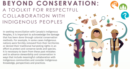
This brief provides an overview of a toolkit that was created by the Indigenous Knowledge Circle of the NBCKC to support individuals and organizations seeking to learn how to do things differently...
Ressource
Author(s)
Anke Günther
Alexandra Barthelmes
Vytas Huth
Hans Joosten
Gerald Jurasinski
Franziska Koebsch
John Couwenberg
Peatlands are strategic areas for climate change mitigation because of their matchless carbon stocks. Drained peatlands release this carbon to the atmosphere as carbon dioxide (CO2). Peatland...