
Search Results
Displaying:
161 - 180 of 271
Remote Camera Survey Guidelines and Metadata Standards for Western Alberta
Resource
This current resource webpage (deployed by GitHub) provides links to the online version of both the Remote Camera Survey Guidelines: Guidelines for Western Canada (RCSC et al., 2023) and Remote Camera...

Reserve Design under Climate Change: From Land Facets Back to Ecosystem Representation
Resource
Our climate envelope projections for the 2080s indicate that virtually all reserves will, in time, be comprised of different ecosystem types than today.

Results of Vegetation Survey as a Part of Neutralizing Lime Sludge Valorization Assessment
Resource
The use of the lime neutralization process is a common technique to treat acid mine drainage (AMD) generated by sulphidic mine wastes. The AMD-contaminated water collected on the mine site is...

Rob Hinchliffe
Contact
Organization
Position Title
Aquatic Invertebrate Coord, Faculty of Science - Alberta Biodiversity Monitoring Institute
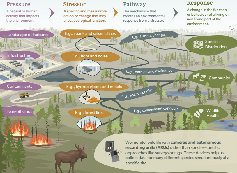
Routes to Response: A Conceptual Framework to Detect the Effect of Oil Sands Industrial Activity on the Land
Resource
The Oil Sands Monitoring Program is assessing the environmental impacts of oil sands development at different spatial scales. Monitoring in the Oil Sands Region operates under a consistent framework...
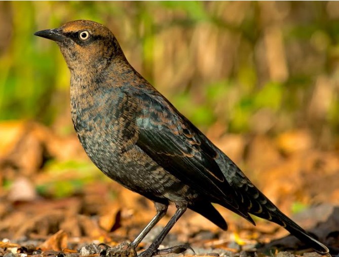
Rusty Blackbird (Euphagus carolinus ) Population and Distribution Data in the Athabasca and Cold Lake Oil Sands Regions of Alberta using Automated Recording Units (ARUs)
Resource
The Rusty Blackbird ( Euphagus carolinus ) was listed as Special Concern on Schedule 1 of the federal Species at Risk Act in March 2009 because of large and longterm declines in population size. The...
Saving Endangered Species Using Adaptive Management
Resource
Adaptive management is a powerful means of learning about complex ecosystems, but is rarely used for recovering endangered species. Here, we demonstrate how it can benefit woodland caribou, which...
Science-informed Policy Decisions Lead to the Creation of a Protected Area for a Wide-ranging Species at Risk
Resource
Protected areas are needed to conserve nature and biodiversity worldwide. The province of Québec (Canada) recently established a large wilderness area affording significant habitat protection for...
SENSR (Services for Environmental Sensor Research)
News
Organization
SENSR (Services for Environmental Sensor Research) is the latest ABMI addition to our national affiliate, the non-profit Biodiversity Pathways. SENSR is dedicated to helping you get the most out of...
Setting a Foundation for Indigenous Knowledge Systems-guided Boreal Caribou (tǫdzı) Conservation Planning in the Western Boreal Region of Canada: A Systematic Map Protocol
Resource
Abstract In recent years, researchers have increasingly recognized the need to bridge Western and Indigenous knowledge systems to strengthen research in wildlife conservation. Historically, this arena...
Slowing Down Wolves to Protect Boreal Caribou Populations: A Spatial Simulation Model of Linear Feature Restoration
Resource
In Canada, boreal caribou ( Rangifer tarandus caribou) are declining in numbers, in part due to increased predation by wolves ( Canis lupus). One management option to reduce wolf–caribou interactions...
Stairway to Heaven or Highway to Hell? How Characteristics of Forest Roads Shape their use by Large Mammals in the Boreal Forest
Resource
By showing which forest roads are more used by caribou predators (wolves and bears) and its apparent competitor (moose), our study highlights the importance of considering both road-scale characteristics and the landscape context in which roads are built to prioritize the most detrimental roads to caribou conservation and guide efficient restoration efforts of its habitat.
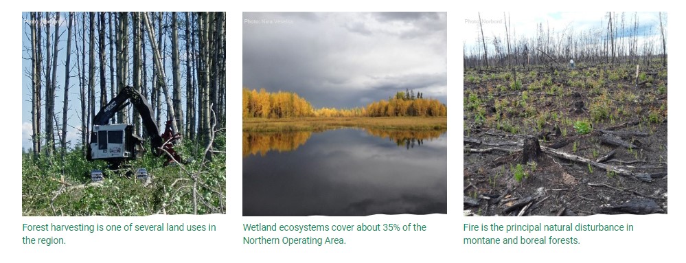
Status of Human Footprint in Alberta
Project
Organization:
The ABMI defines human footprint as the visible alteration or conversion of native ecosystems to temporary or permanent residential, recreational, agricultural, or industrial landscapes. The...

Status of Land Cover and Biodiversity in Norbord Inc.'s Operating Areas
Resource
This online report describes the status of human footprint, species, and habitat in Norbord Inc.'s two main operating areas located in northwestern Alberta. This information establishes baseline...
Testing UAV-based Remote Sensing for Monitoring Well Pad Recovery
Resource
UAV-based remote sensing as a method for monitoring well pad recovery is determined to be feasible from a technical and field perspective.

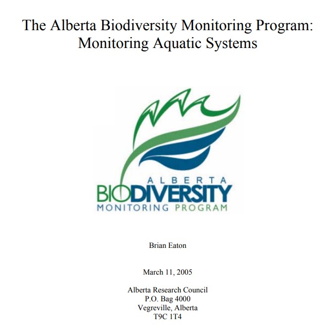
The Alberta Biodiversity Monitoring Program: Monitoring Aquatic Systems
Resource
Protocols for sampling biotic and abiotic parameters in large lakes, large rivers, wetlands, and streams in Alberta is provided. Estimates of time costs are given.
The Biophysical Climate Mitigation Potential of Boreal Peatlands During the Growing Season
Resource
Peatlands and forests cover large areas of the boreal biome and are critical for global climate regulation. They also regulate regional climate through heat and water vapour exchange with the...
