
Search Results
Displaying:
1 - 20 of 26
Guiding Principles for Wetland Stewardship and Forest Management Practitioner Guide
Resource
This practitioner guide provides a user-friendly overview of the interactions between boreal wetlands and forests and what these interactions mean for forest managers working in Canada’s boreal.

Guiding Principles for Wetland Stewardship and Forest Management Technical Report
Resource
This technical report describes in detail the interactions between boreal wetlands and forests and how forest managers can use this information to help avoid or minimize adverse effects on wetlands.

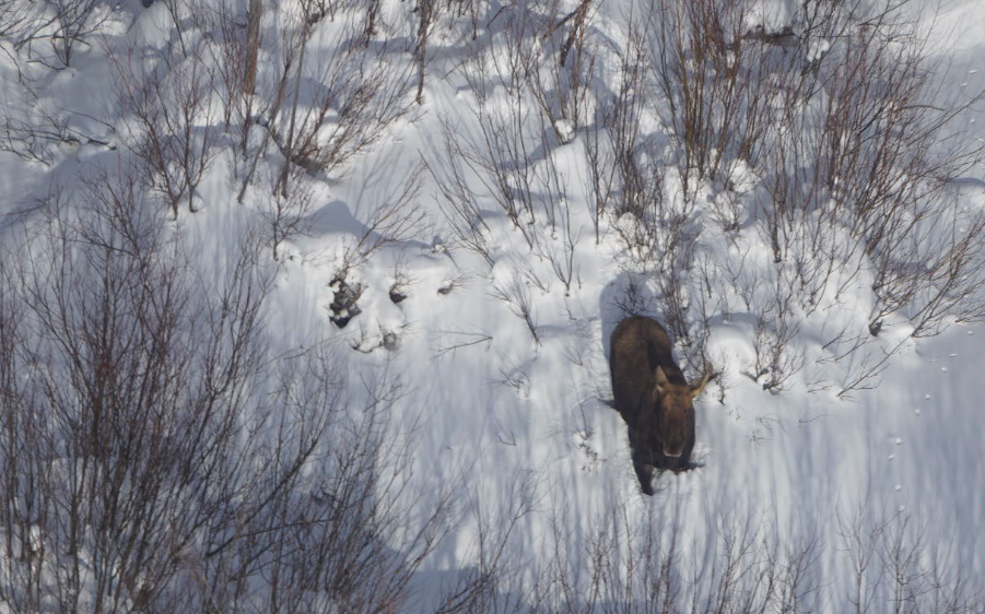
Moose Habitat and Populations in Alberta Boreal and Foothills Regions: Literature Review
Resource
Moose occur across the northern Boreal and Foothills of Alberta (Alces alces). Their core range is in mid- and west-central Alberta and supports the highest densities of moose in the province. The...
Nested Population Structure of Threatened Boreal Caribou Revealed by Network Analysis
Resource
Delineating relevant local populations of widely distributed species is a common challenge in conservation ecology. Caribou and reindeer ( Rangifer tarandus) are in general decline throughout their...

Podcast - Shift talks Sacred Science with Alvin First Rider, Brett Purdy, and Emily Herdman
Resource
Alvin First Rider speaks about his nation's use western science alongside Indigenous Knowledge to bring buffalo back to their historical plains.

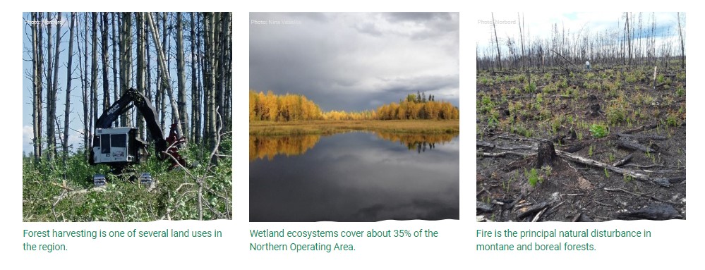
Status of Land Cover and Biodiversity in Norbord Inc.'s Operating Areas
Resource
This online report describes the status of human footprint, species, and habitat in Norbord Inc.'s two main operating areas located in northwestern Alberta. This information establishes baseline...
The Third Generation of Pan-Canadian Wetland Map at 10 m Resolution Using Multisource Earth Observation Data on Cloud Computing Platform
Resource
Development of the Canadian Wetland Inventory Map (CWIM) has thus far proceeded over two generations, reporting the extent and location of bog, fen, swamp, marsh, and water wetlands across the country...

Video - Assessing Cumulative Ecological Effects: The Changing Management Landscape
Resource
Jim Schieck discusses how cumulative effects are currently being assessed in Alberta.

Video - Assessment of forest attributes using airborne and terrestrial LiDAR
Resource
This presentation discusses the different ways that LiDAR data can be effectively used in forestry management applications.

Video - Blood Tribe Buffalo Restoration Project
Resource
Members of the Káínawa – or Blood Tribe – are applying training in western science, alongside their Indigenous Knowledge, to bring buffalo back to their historical habitat in southern Alberta, the...

Video - Building a Sustainable Alberta Through Deployment of LiDAR Technologies: Reflections from an SRD perspective
Resource
Barry White discusses the ways LiDAR is being used by departments within the government of Alberta.

Video - Caribou Conservation Project
Resource
The Denesųłiné of Cold Lake First Nations (CLFN) are applying both their Indigenous Knowledge and expertise in western science to develop and implement diverse caribou conservation strategies in...

Video - Enhanced Fuel Mapping for Wildfire Management
Resource
This presentation discusses ways that LiDAR data can be used in forestry management, including for mapping mountain pine beetle infestations.

Video - Feature Extraction from Multisensor Airborne Data: Monitoring of large-scaled industrial activity on the natural landscape
Resource
This presentation discusses using airborne LiDAR data on monitoring projects with the federal and provincial government. Data collection and data extraction are reviewed.

Video - From Point Cloud to Supporting Decisions: Making use of your LiDAR data
Resource
This presentation discusses how to use LiDAR data, in particular for forestry, but also for other government and industry applications.

Video - High Resolution Inventories Using LiDAR: Challenges and opportunities
Resource
This presentation discuss a pilot project done with Spray Lakes Sawmill FMA related to doing plot inventories using LiDAR.

Video - LiDAR Data Capture and Analysis Standards
Resource
This presentation discusses some of the issues with data collection and analysis that could lead users to require standards.

Video - LiDAR: Demonstrating value to Alberta Parks through 101 uses
Resource
This presentation discusses how Alberta Parks uses LiDAR data to inform decision-making in their land management activities.
