Wetlands Knowledge Search Results
Resource
Authors
Alberta Biodiversity Monitoring Institute
We’re pleased to announce the release of the ABMI Alberta-wide Wetland Inventory—our most up-to-date and high-resolution wetland data yet.
Resource
Authors
Alberta Biodiversity Monitoring Institute
From1999 to 2015, human activity in Alberta visibly converted over 23,000 km2 of native ecosystems into residential, recreational, or industrial landscapes
Resource
Resource Date:
August
2021
With the support of Alberta Environment and Parks, the Alberta Biodiversity Monitoring Institute has become the trusted source for data about habitat, species, and the human footprint.
Resource
Authors
Alberta Biodiversity Monitoring Institute
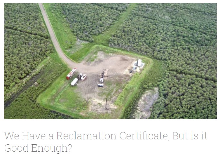
In summer 2013 field crews spent five weeks sampling soil and vegetation indicators at 18 wellsites and adjacent reference sites in the Dry Mixedgrass subregion of Alberta
Resource
Authors
Robert Bott
Graham Chandler
Peter McKenzie-Brown
This book is written to help assess how effectively we have, or are, conserving our land base and providing the stewardship required to pass our legacy on to our progeny.
Resource
Objective - develop a collective understanding of the scope of sites impacted by soil sterilants (bromacil and tebuthiuron) and the specific challenges associated with their remediation and management
Resource
Resource Date:
November
2020
The Vermillion River watershed region, found in central Alberta between Edmonton and Lloydminster, is home to residents and farmers who rely on the watershed for drinking water, agriculture, and...
Resource
This presentation describes a method of assessing cumulative effects, taking into account the many drivers or pressures on the landscape and their effects on watershed processes.
Resource
Resource Date:
March
2013
This presentation discusses the state of wetland and peatland conservation in Alberta.
Resource
Resource Date:
March
2013
This presentation describes how the Alberta oil and gas industry decided to go with a oil/gas spill cooperative rather than having individual company spill response units.
Resource
Resource Date:
March
2013
This presentation summarizes a 6 year project to evaluate the environmental and economic performance of agricultural BMPs to improve water quality on small watercourses in Alberta.
Resource
This presentation provides an example oaf how Wet Areas Mapping and LiDAR can be used as a tool to monitor biodiversity.
Resource
Resource Date:
March
2013
This presentation describes what the Bow River Watershed Council learned through the various iterations of its watershed plans and state of the watershed reports.
Resource
Resource Date:
March
2013
This presentation describes the watershed planning process for the Vermilion River.
Resource
Resource Date:
March
2012
Barry White discusses the ways LiDAR is being used by departments within the government of Alberta.
Resource
Resource Date:
March
2013
This presentation discusses what watershed education looks like in the Red Deer River watershed.
Resource
Resource Date:
March
2013
This presentation provides a summary of the Plains Pipeline spill in the Red Deer River, June 7, 2012.
Resource
Resource Date:
March
2013
This presentation describes how focusing on functional flows versus typical water conservation management could improve aquatic in-stream ecosystems while meeting current water allocations.
Resource
Resource Date:
March
2012
Jae Ogilvie presents on his group's research related to the use of Wet Areas Mapping data to predict the flow of contaminants from the Rainbow pipeline spill in northern Alberta in 2011.
Resource
Resource Date:
March
2013
This presentation reviews the forest management planning for Hidden Creek, a tributary to the Oldman River in southwestern Alberta.