
Search Results
Displaying:
1 - 20 of 29
A Long Time Ago in the Future: Caribou and The People of Ungava: Ungava Peninsula Caribou Aboriginal Round Table
Resource
The Indigenous Peoples of Ungava self-organized into the Ungava Peninsula Caribou Aboriginal Round Table (“UPCART” or “the Round Table”) in early 2013. For the first time in human history the Peoples...

A Strong Mitigation Scenario Maintains Climate Neutrality of Northern Peatlands
Resource
Northern peatlands store 300–600 Pg C, of which approximately half are underlain by permafrost. Climate warming and, in some regions, soil drying from enhanced evaporation are progressively...

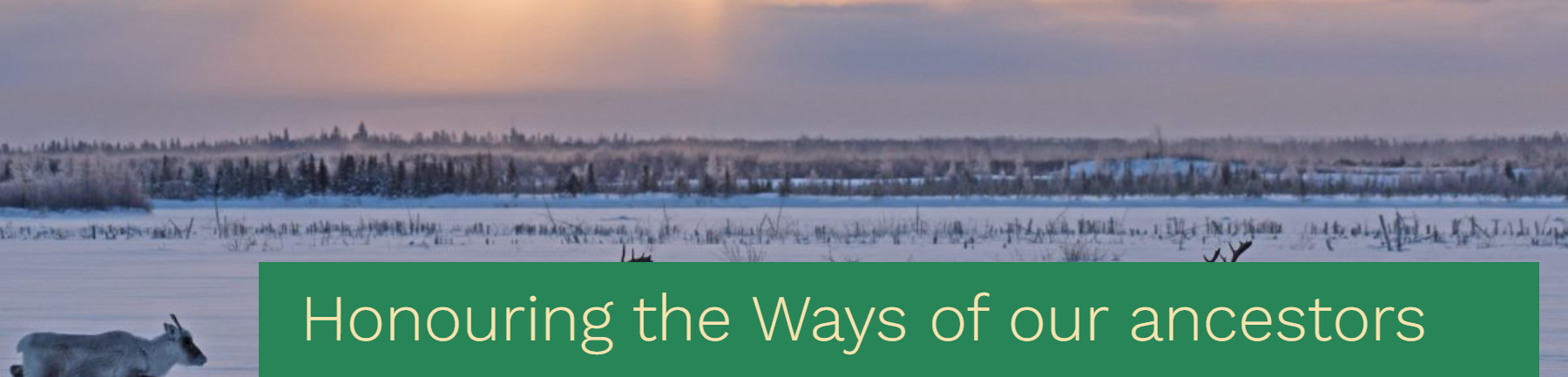
Honouring the ways of our ancestors, the Cree and Innu Nations sign a traditional understanding built from the customary values of sharing, sustainable harvest and respect for the caribou
News
Organization
The Maamuu nisituhtimuwin/ Matinueu-mashinaikan atik u e uauinakanit establishes mutually agreed upon terms by which Innu communities in Québec will be able to access caribou within the Cree...
Integrating Traditional and Evolutionary Knowledge in Biodiversity Conservation: A Population Level Case Study
Resource
Despite their dual importance in the assessment of endangered/threatened species, there have been few attempts to integrate traditional ecological knowledge (TEK) and evolutionary biology knowledge...

Podcast - Shift talks Sacred Science with Alvin First Rider, Brett Purdy, and Emily Herdman
Resource
Alvin First Rider speaks about his nation's use western science alongside Indigenous Knowledge to bring buffalo back to their historical plains.

Review on PRNP Genetics and Susceptibility to Chronic Wasting Disease of Cervidae
Resource
This review summarizes our current understanding of CWD control, focusing on PRNP genetic, strain diversity and capacity to infect other animal species, including humans.
Sacred Science Video Series
Project
Organization:
Bringing together Indigenous knowledge and western science creates opportunities for new solutions to environmental challenges, including issues that are important to Indigenous People. The Sacred...
The Third Generation of Pan-Canadian Wetland Map at 10 m Resolution Using Multisource Earth Observation Data on Cloud Computing Platform
Resource
Development of the Canadian Wetland Inventory Map (CWIM) has thus far proceeded over two generations, reporting the extent and location of bog, fen, swamp, marsh, and water wetlands across the country...
Video - Assessing Cumulative Ecological Effects: The Changing Management Landscape
Resource
Jim Schieck discusses how cumulative effects are currently being assessed in Alberta.

Video - Assessment of forest attributes using airborne and terrestrial LiDAR
Resource
This presentation discusses the different ways that LiDAR data can be effectively used in forestry management applications.

Video - Blood Tribe Buffalo Restoration Project
Resource
Members of the Káínawa – or Blood Tribe – are applying training in western science, alongside their Indigenous Knowledge, to bring buffalo back to their historical habitat in southern Alberta, the...

Video - Building a Sustainable Alberta Through Deployment of LiDAR Technologies: Reflections from an SRD perspective
Resource
Barry White discusses the ways LiDAR is being used by departments within the government of Alberta.

Video - Caribou Conservation Project
Resource
The Denesųłiné of Cold Lake First Nations (CLFN) are applying both their Indigenous Knowledge and expertise in western science to develop and implement diverse caribou conservation strategies in...

Video - Enhanced Fuel Mapping for Wildfire Management
Resource
This presentation discusses ways that LiDAR data can be used in forestry management, including for mapping mountain pine beetle infestations.

Video - Feature Extraction from Multisensor Airborne Data: Monitoring of large-scaled industrial activity on the natural landscape
Resource
This presentation discusses using airborne LiDAR data on monitoring projects with the federal and provincial government. Data collection and data extraction are reviewed.

Video - From Point Cloud to Supporting Decisions: Making use of your LiDAR data
Resource
This presentation discusses how to use LiDAR data, in particular for forestry, but also for other government and industry applications.

Video - High Resolution Inventories Using LiDAR: Challenges and opportunities
Resource
This presentation discuss a pilot project done with Spray Lakes Sawmill FMA related to doing plot inventories using LiDAR.
